
Abstract
This chapter presents the historical place of the urban setting that has shaped various social, economic and political transformations in Africa. It presents several examples of African cities that existed in the pre-colonial period. It also shows how the African urban space remarkably changes during the colonial period both quantitatively and qualitatively. Some pre-colonial African cities were overtaken by colonial cities along with a significant change in terms of urban planning and provision of basic infrastructure. After independence of African countries, urbanization has accelerated with the apparition of large cities, but with the influence of the colonial urban planning. Today over half a billion of African population live in urban areas. This African urban population is projected to reach 1 billion in 2040 and 1.5 billion in 2050.
Access provided by Autonomous University of Puebla. Download chapter PDF
Keywords
- Africa
- History
- Urban spaces
- Religions
- Cultures
- Cities
- Urbanization
- Colonization
- Migration
- Rural
- Urban systems
- Mega cities
2.1 Introduction
As people have histories, cities do too. The historical urban setting that has shaped various social, economic and political transformations in Africa had been overlooked in various studies of African human settlements in the pre-colonial area. However, several archaeological and anthropologic studies demonstrate that cities emerged in Africa long before the European colonialism.Footnote 1 As noted by Coquery-Vidrovitch et al. (1993 and 2009), “Cities have existed in sub-Saharan Africa since antiquity. But only now are historians and archaeologists rediscovering their rich heritage: the ancient ruins of Great Zimbabwe and Congo, the harbor cities at the Indian Ocean, the capitals of the Bantu Kingdoms, the Atlantic cities from the 16th to the 18th centuries, and the urban revolutions in the 19th century”.Footnote 2 Though African societies were predominantly rural during the pre-colonial era, pre-colonial African urban settlements exhibited economic, comparative opportunities, as well as political and social advantages long before the arrival of European colonisers as also noted by zu Selhausen (2016) (Fig. 2.1).Footnote 3

Geographical location of pre-colonial African cities.
However, there has been noticeable transformation of the African urban space consistent with the European colonial conception of cities, particularly in terms of urban planning.Footnote 4 Independence of African countries (during mostly the 1960s) also marked a significant turning point in African urbanization with massive migration from rural areas seeking jobs, particularly to capital cities. This has shaped the African urbanization in terms both of population numbers and urban systems. In 2018, half a billion of African people lived in urban areas. This urban population is projected to grow to one billion in 2040.Footnote 5 Africa’s rapid urbanization provides opportunities for economies of scale and agglomeration, but it will also come with challenges that call for large investments in infrastructures to respond to the increased demand for water, sanitation, solid management, energy and mobility. These challenges are largely determined by the way cities grow and form the urban space.
The dynamic transformation of African urbanization has occurred in different paces, times and places. Along the African urbanization, cities form and grow in many different parts of the continent for various different reasons, such as rural-to-urban migration, economic opportunities, politics, natural disasters, social conflicts, etc.Footnote 6 In a given country, these factors associate to determine the size and national distribution of cities. In Africa, as it is observed elsewhere, natural population increase (decrease in mortality and increase in fertility) and massive migration rural to urban, particularly during the post-independence period (starting at 1960 for most African French colonies) have also contributed to rapid urbanization.
Considering that cities had existed in Africa long before the European colonisation, this chapter presents, in its Sect. 2.2, different forms of African cities during the pre-colonial period in terms of geographical locations, urban form and structure, city size, land use and population and density, architecture, culture and heritage. Section 2.3 presents the transformation of the African urban space along the colonial era and post independence. Section 2.4 presents the Africa’s urban transition since the end of the 20th century and the beginning of the 21st century. The Sect. 2.5 present the urbanization and the emergence of large size cities in the African region while the Sect. 2.6 National analyses national urban systems in Africa.
2.2 African Cities in the Pre-colonial Period
2.2.1 History of Pre-colonial African Cities
-
People have histories; cities do too
Urbanization in Africa is a complex process, with diverse relationships that form around class, ethnicity, race, occupation, and religion across pre-colonial, colonial, and contemporary urban spaces. Cities existed in Africa long before the European colonialism.Footnote 7 The dynamic transformation of African urbanization occurred in different paces, times and places. African urbanization was indeed a dynamic and long-term process, expressing as much continuities as changes. As noted by Coquery-Vidrovitch (2005):
Most of the time, these changes were not sudden, but resulted from long and often imperceptible adjusting processes, the accumulation of which resulted in revolutions of mind and society: urban spaces came to embody urban minds. These cultural trends were all the more decisive because they diffused from city centres to the whole of African societies. In short, cities, which in the nineteenth and twentieth centuries became the major locations for labour markets and political struggles, were definitely decisive places for cultural and social change.Footnote 8
Archaeological works have shown different forms of urban centres and towns in Africa during the pre-colonial period.Footnote 9 Long before the penetration of Islam in Africa and the European colonialism, various forms of cities and towns existed in the African continent in respect to urban planning, provision of basic services, economic exchanges and social interactions. These forms of cities emerged from Western to Eastern, Northern to Southern and central Africa. In every corner of Africa, there were some forms of existence of towns and cities based on social, economic and political opportunities. As noted by Salm and Falola (2004), the African urbanization is historically rich and dated back thousands of years in ancient Egypt, the Western Sudan, Nigeria, Ethiopia, the East African City States, and Southern Africa, long before the arrival of European colonisers.Footnote 10
Historical facts are always determinant for a better understanding of levels and trends of events. As noted by Coquery-Vidrovitch (2005),Footnote 11 cities existed in Africa in ancient archaeological times and during the age of medieval Islam. Selected sites for early urban centres exhibited economic, comparative opportunities, such as on soils, water sources, minerals, and trade potential, as well as political and social advantages. The early African urban development was indeed associated with agriculture and the Neolithic revolution. This led to high population densities that propelled economies of scale and agglomerations and new forms of specialization as well as political and administrative organizations.Footnote 12
As further noted by Coquery-Vidrovitch (2005) “In time and space African cities expressed a social and cultural evolution resulting from the interrelationship between urban people and their environment, structured along given political and social factors, and ecological, technological, and ideological constraints”.Footnote 13 For instance, in West Africa, several urban centres such as Jenne-Jeno (Djene) in Mali existed long before the arrival of European settlers.Footnote 14 Jenne-Jeno in the 3rd century BCE benefited from numerous comparative advantages, such as productive rice-farming conditions and good pasturage. Its geographical position adjacent to Niger River was equally central to its development with the migration of populations during the Sahara aridity that began around 1000 BCE. Jenne-Jeno, finally made of a group of urban settlements along the inner Niger River floodplain of Mali, was “seen as a composite or clustered city marked by the aggregation of semi-specialized settlements with coordinated activities”.Footnote 15 This is the first characteristic of what is called today city region where a central city is linked to several cities around it with specific activities associated to each urban centre. In the same region of Mali, the trans-Saharan trading town of Timbuktu also emerged in the 15th century as an intellectual, spiritual and Islamic capital in Africa and beyond.Footnote 16
The city-state of Ife (Ile-Ife) of Nigeria was also strategically located near the headwaters of the Oni River, which flows into the Atlantic, and at the juncture of forest and savannah; it sits on high ground that is surrounded by wetlands, hills, and a fertile savannah plain.Footnote 17 Through cooperation in trade and others services, settlements in the hills might also form together a single urban centre.Footnote 18, Footnote 19 The larger Ife area also functioned as a natural elephant-trapping area where local groups could block escape routes from the Ife valley wetlands.Footnote 20 Through the Niger–Benue River confluence, Ife was also able to access to distant trade centres.
On the East African coast, as noted by zu Selhausen (2016),Footnote 21 we also have the Arab trading hubs of Mombasa and Zanzibar that functioned as centres around which societies were organized; they served as focal points of trade, political authority, military garrison, religious and cultural ceremonies, or as refuge and collective shelter in troubled times. Swahili coastal sites, such as Kilwa and Mombasa, also benefited from the Indian Ocean trade in gold, ivory, and other goods. The earliest known cities of Africa emerged around the Nile Valley—the most famous being Alexandria in Egypt. Also the kingdoms of highland Ethiopia organised themselves around towns two thousand years ago. Later, in the 11th century the kingdom of Great Zimbabwe in southern Africa also constructed a complex walled city.Footnote 22 Urbanization in East Africa drastically increased throughout the nineteenth century with the international growth of the Sultanate of Zanzibar following the “Swahili urbanism”.Footnote 23
In the pre-colonial era, while villages were mainly composed of people from the same ethnic group, usually referred to tribes, African cities were often inhabited by different ethnic groups. They were, indeed, featured not only in terms of their size but also particularly by their degree of heterogeneity as being the place where people from different localities agglomerated for different social, economic and political purposes. This marked the fundamental function of roads and the choice of locations for human settlements. Memphis (near modern Cairo) was one of the most heterogeneous urban settlements with diverse population groups hailing from different places, such as Syria, Phoenicia, Canaan, and Kush (the latter in modern Sudan). Swahili cities were also composed of different ethnic groups, including African indigenous, Arabic, and Persian, along their 1500 km coastal region. Aksum city (400 BCE to CE 619), situated in modern Eritrea, was also an important early urban centre, a compact city inhabited by political and trade elites, with producers at the centre’s outskirts. Between the 11th and the 16th century CE, the Tellem and the Dogon populations also merged in Bandiagara Escarpment of Mali with the creation of densely populated and ethnically diverse centres featuring an integrated culture based on agricultural innovation (irrigated onion farming), technological and ritual specialization (iron working and so on), and various forms of external trade.Footnote 24
2.2.2 Planning of Pre-colonial African Cities and Towns
One key element of urban planning is the street. Pre-colonial African cities and towns were organized along streets and roads with the main purposes of mobility, commerce and social interactions. Streets, as public spaces, linked residential houses, commercial buildings and other structures to fulfil their social, economic and political functions that are crucial to urban life in any time period. The traditional, pre-colonial urban settlement was also one with a central meeting place for transactional activities, such as commerce or governance, surrounded by housing, workshops, and neighbourhood services, with the wealthiest and most influential inhabitants living closest to the centre. Streets radiated from the nucleus of the city, which was usually the seat of political power or place of worship, such as a mosque, a temple or a cathedral, or some other structure(s) of political, commercial or cultural significance, such as a royal palace. They shaped the urban form and structure by separating blocks and linking different places of interest within the city.Footnote 25
Urban form and structure in the pre-colonial area result from organic urban planning and design principles that feature clustered layouts around compound.Footnote 26, Footnote 27 The principles of the layout of pre-colonial African cities favour the circularity in the pattern of dwellings, streets, walls, plazas and settlement patterns. As noted by Amankwah-Ayeh (1996), “circularity in African culture reveals a hierarchy in the urban structure which does not lead to alienation of the masses but maintain a good sense of control of the environment.” According to Mabogunje (1962), the rational of the circular nature of Yoruba dwellings, shelter, town form and plaza design was glued on the Yoruba’s belief that the form of the world is circular, and, because of the two road axes (oriented N-S and E-W) which intersect at the world centre is divided into halves and quarters.Footnote 28 The principles of circularity were also prevalent in Southern Africa as documented by Frescuro (1981) and Hull (1976).Footnote 29
Streets played, indeed, a central role in the planning and designing of Yoruba cities. For instance, by the early 15th century, the city of Ile-Ife was reconfigured around a central plan that was defined by a circumscribing moat-wall, broad avenues leading to a central palace and adjacent market, as well as wards extending radially from the centre.Footnote 30 Festivals and political events generally took place in city centres served with large squares. Yoruba cities were generally sited on hills, where palaces are the most prominent architectural feature; Their design based on striking axes and sightlines, along with a grid style radial form as part of defining characteristics of urban forms and structures, was a key component of refined urban planning in pre-colonial Africa. The Kano chronicle dates the first permanent market in Kano to the 15th century. Later that century, the Kano city walls were extended and a centralized palace and a new market were built. In symbolic terms, Hausa urban settings carried varied cosmological significance, based in part on orientation toward the cardinal directions and the positioning of special gates.Footnote 31
In Yoruba cities, planning and architecture are linked to feature the urban form and structure. Centrally placed within most Yoruba towns was the palace of the Oba the head of the city administration and the symbol of its urban status. So important was the palace that its grounds occupied an extensive area of land. Opposite the palace was the most important market of the city.Footnote 32
-
African Walled Cities in the pre - colonial era
The circularity of pre-colonial African cities was also justified by the fact that there was a necessity to create walled cities. Throughout history, one of the protection strategies against an external enemy was to build a walled city. Walls were usually massive structures, punctuated with guard towers. Some were built on hills, making invasions more difficult, while others fronted seas and oceans to protect the towns from invaders in ships or, in some cases, pirates. Wall systems also played a role in the control of merchants and goods for purposes of taxes, tolls and the reduction of smuggling. Today well-preserved walls bring tourist from across the world to wonder around these medieval walled cities.Footnote 33 Walled cities have been common in Africa’s pre-colonial era as a means of protection from hostile neighbouring communities. In these walled cities, the palace was positioned at the middle of the city. Walled cities or settlements were found in ten African countries: three in Algeria (including Algiers), three in Egypt (including Cairo), one in Ethiopia (Harar), 15 in Libya (including Tripoli and Benghazi.), three in Mali (Djenne, Gao and Timbuktu), 28 in Morocco (including Casablanca, Marrakech, Meknes and Rabat), one in Niger (Zinder), three in Nigeria (Benin City, Kano and Keffi), four in Tunisia (Kairouan, Sfax, Sousse, Tunis), and one in Zimbabwe (Great Zimbabwe).Footnote 34
Box 2.1 The Great Walls of Benin
The Walls of Benin were a combination of ramparts and moats, called “Iva” in the local language, used as a defense of the defunct Kingdom of Benin, which is present-day Benin City, the capital of present-day Edo, Nigeria. It was considered the largest man-made structure lengthwise and was hailed as the largest earthwork in the world. It is larger than Sungbo’s Eredo in Southwest Nigeria.Footnote 35 It enclosed 6500 square kilometres of community lands. Its length was over 16,000 km.Footnote 36 It was estimated that earliest construction began in 800 CE and continued into the mid-15th century. Benin City was described as “wealthy and industrious, well governed and richly decorated. This is the story of a lost medieval city you’ve probably never heard about. Benin City, originally known as Edo, was once the capital of a pre-colonial African empire located in what is now southern Nigeria. The Benin empire was one of the oldest and most highly developed states in west Africa, dating back the 11th century.

https://upload.wikimedia.org/wikipedia/en/b/bc/Afrifortifiedvillagbige.jpg
The Benin Walls were ravaged by the British in 1897 during what has come to be called the Punitive expedition. Scattered pieces of the structure remain in Edo, with the vast majority of them being used by the locals for building purposes. What remains of the wall itself continues to be torn down for real estate developments.Footnote 37 Benin City, the mighty medieval capital, is now lost without trace. With its mathematical layout and earthworks longer than the Great Wall of China, Benin City was one of the best planned cities in the world when London was a place of “thievery and murder”.
Source: Sola rey, 2016: http://solarey.net/great-walls-benin-west-africa/.Footnote 38
In terms of housing, architecture and organization, Blier (2012) also noted three historic patterns of urban settlements in the pre-colonial Africa:
-
(a)
Monumental urbanism, especially prominent in north, eastern and southern Africa (from Egypt and Eritrea to Zimbabwe), was characterized by substantial permanent structures in stone;
-
(b)
Satellite urbanism, found especially in West Africa (from Mali to northern and southern areas of Nigeria), was characterized, on one hand, by its earthen structures and, on another hand, by the collaboration between interlinked community clusters that together create an urban settlement structure and;
-
(c)
Migratory or peripatetic urban settlements, found mostly in central Africa, were characterized by the nomadic identity of their population. In the latter, following the death of a ruler or a sequence of traumatic events, interlinked cities were often re-established on a new site.
Classification from Coquery-Vidrovitch (1993 and 2009) puts forward notions of: (a) mercantile cities that opened Africa to the world, (b) Islamic cities that became centers of scholarship and the trans-Saharan trade, (c) Creole cities that appeared after the first contact with Europeans, and (d) Bantu cities of the hinterland that reacted against them.Footnote 39
The architecture of metropolitan centres in Egypt features an array of monumental building forms serving multiple functions, some dating back to the pre-dynastic and early dynastic periods.Footnote 40 They were among the largest and most durable centres in the global urban history. The most fascinating architecture was observed in the ancient cities of Egypt that featured the “monumental urbanism”. The Shona capital of Great Zimbabwe, which flourished in the 11th–14th centuries CE, also displayed durable structures made of stone. During the 8th to 19th centuries CE, cities on the East African coast also displaced elaborately decorated, stone-like, coral edifices. The city of Jenno-Jeno displayed durable structures with walls, 3.7 m wide at the base, made with cylindrical brick building forms.Footnote 41 In the West African savannah area, the Mande architectural sources were also identified as symbolic organization consistent with utopian idioms, defined by flexible anthropomorphic design referents, which was a feature of other populations.Footnote 42 The use of domes was particularly promoted in the Hausa urban architecture. However, decorative features varied from one urban setting to another, with palaces, merchant residences and mosques being particularly ornamental.
Pre-colonial African architecture featured attributes of local building materials providing unique possibilities for urban and housing sustainability as it is sought in today’s national and global agendas. Target 11.c, of the Sustainable Development Goal (SDG) 11 aims to support least developed countries, including through financial and technical assistance, in building sustainable and resilient buildings utilizing local materials.Footnote 43
In the pre-colonial period, for human settlements geographical locations always matter for several reasons and particularly for accessibility and existence of natural resources. During the pre-colonial period, means of mobility were mainly either walking or riding animals, such as horses and camels. Under these circumstances, accessibility was a key factor for the choice and planning of places for human settlements. The proximity to rivers and/or mountains as well as being central axis plans with bilateral siting of key structures was significant determinant for most urban centres. For instance, Hausa cities were located to sites close to the intersections of major trade routes, valued resources, especially iron, and powerful spirit locales.Footnote 44 They are economically and politically linked within a system of satellite urban settlements, as noted by d by Blier (2012), with the five-six main Hausa cities furnishing key goods or services within the larger network: (a) textiles from Kano, (b) markets in Katsina and Daura, (c) militias from Gobir, and (d) slaves from Zaria.Footnote 45, Footnote 46
According to Hull (1976) (cited by Amankwah-Ayeh 1996),Footnote 47 The Ibo people of Nigeria achieved an efficient use of space, living in homes that were clustered in plan. Within an area of high population density, hundreds of Ibo villages separated by large open spaces and groves of shady trees that led to ‘extended’ family meeting places. A central market place was the focus of all the paths that led from the ‘extended’ family meeting places.
Pre-colonial African urban centres also recognized the benefits of inter-communal cooperation for their economic development as well as political strength long before the arrival of European settlers. The communal need to address complex issues associated to disaster prevention, protection, manufacturing, trade control, hunting was also determinant for inter urban centres cooperation. In the 16th century, African communities were conscious of the need of inter-city cooperation for a drainage system to prevent flooding and other natural disasters. For instance, the setting of the Luba Kingdom (1585–1889) situated in the wet grasslands of the Upemba depression, with the source of the Zaire River to the southeast, was critical to its political development, encouraging shared communal activities and cooperation in the creation of dams and drainage systems to counter seasonal flooding, which might impact various sectors from housing to agriculture and fishing.Footnote 48 Economic performance of Luba and other connected urban centres was anchored on agriculture, specialized metal work, and trade in salt, iron, charcoal and copper (from the Zambian copper belt), as well as cowrie shells and glass beads from the Indian Ocean.Footnote 49, Footnote 50
In pre-colonial African towns and cities, nature conservation and environmental protection measures were also emphasized in the planning and design of human settlements. For instance, in eighteenth-century Mbanza Kongo this was anchored in the building of large-spaced houses around existing trees to avoid disrupting the ecological balance.Footnote 51 The traditional building rules practised in the Bangala towns in present day northern Zaire (Congo) constitute other examples where towns have to be bordered by rectangular patches of banana plants and double rows of palm trees (Vansina, 1973).Footnote 52
2.2.3 City Size, Land Use and Population Density in the Pre-colonial Era
Though population and area figures were seldom estimated during the pre-colonial era, studies have indicated that pre-colonial African cities were sufficiently populated and dense to provide relative economies of scale and agglomeration. In 1661, Riccioli estimated the African population at 100 million inhabitants.Footnote 53 However, during the 17th century, a decline of African population was noted and might be associated to climate and other geologic conditions that expose people to high morbidity as it was also observed in many parts of the world.Footnote 54 In the 18th century, the slave trade accelerate the decline of African urban population (Figs. 2.2 and 2.3).Footnote 55

Source Hayashi (2007)
Estimates of African population from several sources.

Source Hayashi (2007)
Major cities in sub-Saharan Africa.
Similarly to the scarcity of country data, urban data was very limited. Where data was available, it is noted there are African cities that had more than 100,000 inhabitants during the pre-colonial period, figure similar to the population of New York in early 19th century. For instance, in the 12th–15th centuries, the Ife metropolitan area might have occupied an area of 3000 hectares, with a population of about 130,000 inhabitants, or a population density of 43 persons per hectares, which was sufficient to propel economies of scale and agglomeration as well as diffusion of ideas and technological innovations. More than thousands years BCE, available estimates indicate that some African cities were already of more than 10,000 inhabitants. For instance, the Shona capital of Great Zimbabwe might have had a population 18,000 inhabitants in an area of about 722 hectares.Footnote 56 Memphis, founded around 3100 BCE, as the administrative, religious and trade centre of the lower Egypt, was considered probably the largest world metropolis around 2250 BCE with an estimated population range of 6000 to 30,000 inhabitants.Footnote 57 By CE 850 when it functioned as a single urban complex, Jenno-Jeno occupied an area of 41 hectares.Footnote 58 Some studies have linked the size of pre-colonial African cities to the type of government, with cities cites governed by a central authority being of large size. In absence of central authority, cities have the tendency to be of small size; this allow to maintain a feeling of smallness and intimacy keeping strong social, economic, cultural and physical linkages even in areas of high population densities.Footnote 59
However, most of these early urban centres rarely appeared on official national population estimates that mostly included only large urban agglomerations. Without being part of the UNESCO heritage sites, these early African urban centres would be forgotten and/or remain unaccounted for. In fact, during the colonial period, numerous pre-colonial African cities were either destroyed or downgraded in economic importance due to colonisers’ politico-economic objectives.
2.2.4 Cities—Engine of Economic and Political Power During the Pre-colonial Era
Based on their economic, social and political functions as well as their connected geographical locations, pre-colonial African cities were engines of economic development well before the contact with Islam and the European colonisers. Compared to rural areas, they allowed social interactions as well as commercial transactions for agricultural goods and other value-added metals. Though their economic transactions may not be comparable to those of today, towns in the pre-colonial period promoted economies of scale and agglomeration compared to rural areas. It is also of importance to note that pre-colonial African cities cooperated beyond the African territory, showing that globalization dated back the ancient era. As noted by Blier (2012), by the end of the first millennium CE, the Igbo area was already trading with southwest Asia and creating works of extraordinary complexity in bronze and elaborate burial forms at Igbo Ukwu sites. Kilwa, an international African port, produced its own currency in the 11th–14th centuries.Footnote 60 Strong economic centres were the driver of the prosperity and sustainability of empires. Today, Information and Communication Technologies (ICTs) make it easier to cooperate globally, and African cities must take these opportunities and reach the world with competitive products and services. In addition, ICTs foster social transactions and allow social and cultural heterogeneity. They also promote diffusion of ideas and innovations.
In Yoruba oral traditions, a complementary satellite-style urbanism is supposed to have characterized the city-state of Ife (Ile-Ife) by the end of the first millennium. Obalufon also appears to have had diplomatic and trade treaties with several other Yoruba cities, along with military and tribute agreements with affiliated crown cities for the provision of certain goods.Footnote 61 Other established Yoruba cities were Ibadan and Lagos, which were later formed as military camps. Whatever the origins, Yoruba metropolitan centres grew to enormous scale and featured unique craft specialization (from metal- and glass working to weaving and dyeing), marked population diversity (through trade and war) and major population shifts throughout the year (many inhabitants moving to distant agricultural fields for part of the rainy season).Footnote 62 All these cities exhibited different urban forms and structures in terms of streets, housing and architecture; they were shaped in manner, which reflects their economic and political power.
2.2.5 Decentralized Administration and Governance Started with the Pre-colonial African Cities
During the pre-colonial several African urban settlements were based on decentralized administration and governance as it was observed in the Lebou Group in Dakar (Senegal) in the 15th and the 16th centuries (Box 2.2).
Box 2.2 Decentralized administration and governance in the first settlements in Dakar by the Lebou group
The first settlements in Dakar, particularly in Yoff located to the north of the city and in other areas such as Ouakam, Ngor and Camberene during the 15th and 16th centuries were influenced by the Lebou groups’ system of governance that promoted decentralized social, economic and political structures, including integration among various ethnic groups. The Lebou group was, indeed, a symbiosis of various ethnic groups. The Lebou system of governance, which was the opposite of the kingship system practiced in other parts of Senegal, promoted equality among community members, and creation of autonomous villages that constituted the settlements of Yoff. Each village was under the leadership of a “Djaraf”, assisted by a “Ndeye ji Rew” for interior and foreign affairs, and a “Saltigue” who was in charge of land, water and local communities. With the influence of Islam, the function of Serigne Ndakarou was introduced in late 18th century to provide justice based on the Quran. Until today, the Lebou community conserves its socio-political structure where the Serigne Ndakarou and other local authorities still play a key role.Footnote 63
Settlements of the Lebou group in 15th and 16th centuries in the Peninsula of Cap Vert (Dakar).

Source: Mboup et al. (2018).
2.3 Transformation of the African Urban Space in the Colonial and Post Independence Eras
For centuries, Europeans had colonialized most African countries. Prior to that, the African continent was devastated by slavery. Slavery and colonization considerably impacted the African urban population. Though we do not have a global number of their impact, tentative estimates indicated that more 100 million Africans were deported to America and Europe, and over 100 cities were destroyed or downgraded. Estimates from Carr-Saunders (1936) suggest that the slavery had drastically reduced 650 million Africans in 1500 to 150 million level in 1900.Footnote 64 Archaeological works indicated that the city of Ife, with a population of 18,000 inhabitants in the 5th century, would have a population of over 1 million in 1950 if it was not exploited through slavery and colonization. However, according to the UNDESA World Urbanization Prospects of 2015, Ife had a population of only 107,000 in 1950. Colonisation might have affected Ife in various ways particularly weakening its economic and political importance with the choice of Lagos and Ibadan as privileged places for Europeans settlers. In 2015, the population of Ife is only 1 million inhabitants while Lagos was a megacity with 13 million inhabitants and Ibadan a large city with a population of 3.1 million. Similar situations had existed in many African countries where pre-colonial cities had declined in population size associated to their loss of economic and political power for other colonial preferred cities.
2.3.1 Emergence of Colonial Cities and Prime Settlements in the Colonial Era
Some African capital cities were a result of the process of transformation of former pre-colonial urban centres to fit the new interest of European colonisers. The history of the city of Dakar in the extreme west of Senegal is also marked by several migrations dating back to the 14th century. The most prominent recorded settlements were however in the 15th and 16th centuries when the Lebou group settled in the area called “Yoff” located to the north of the city and in other areas such as Ouakam, Ngor and Camberene. The second major settlement was recorded later in the 19th century when the French colons started to settle to the extreme south of the city, which later became the center of the city—hosting most administrative and state buildings (including the State house, the Parliament and the Court house). Both settlement eras had varying influence on the city form of Dakar, which has resulted into two unique spatial organization patterns—an organic pattern evident in the Yoff area and a grid system evident in the French occupied southern parts.Footnote 65 Lagos started around the Island and Mainland areas and served as a major slave trade centre between 1404 and 1889. It was captured by British forces in 1851, annexed as a British colony in 1861 and became the capital (regional administrative centre) of the colony and protectorate of Nigeria in 1914, a status it maintained until 1991 when the country’s capital was formally moved to Abuja. Lagos has been administered under a variety of territorial schemes. When it was ceded to the British in 1861, it was administered as a city-state with its own separate administration. In 1866 it was included in the West African Settlements under a Governor-in-Chief resident in Sierra Leone, but retained a separate legislative council and a local administration. Various changes followed, through its status as a separate colony, to its merger with Western Nigeria in 1951. When Lagos state was carved out as one of the then 12 states in the federation, Lagos assumed new role as a regional administrative centre.Footnote 66
Box 2.3 Geographical location matters for human settlement
Usually in the past as in the present, there have been good reasons why towns developed where they currently are. For some of the larger areas of settlement in Africa the location of natural resources (e.g. water, energy sources, copper, gold and diamonds) was important in determining where people settled in the first place at the beginning of the colonial era in the late 19th century. For example, completely new industrial-urban economies emerged as a direct consequence of the discovery of minerals in Southern and Central Africa. Rapidly urban areas started to grow around industrial plants and housed the mining companies’ administration and workers. The first mineral discoveries in the late 19th century in regions that attracted migrant labourers were for example Johannesburg, Witwatersrand (gold) and Kimberly (diamonds) in South Africa, Kitwe and Ndola in Northern Rhodesia (now Zambia), and Lubumbashi (copper and cobalt) in the southern Congo (now Democratic Republic of Congo). Those areas grew rapidly into industrial mining, smelting and refining towns creating vast employment opportunities in the factories as well as offering a market for agricultural products for surrounding farmers. South Africa became the largest producer of gold in the world and the majority came from the mining town of Johannesburg, which already by then had a population of 250,000, the largest urban centre in sub Saharan Africa. Mining created an urban-industrial civilization with rapid urbanization process contrary to the more gradual development of towns in non-mining areas.
The construction of the railway by colonial administrations for the extraction of natural resources and cash crops (e.g. cocoa, cotton, coffee, tobacco, sugar, and palm oil) to the coast also played an important role in determining the location of harbour towns for exports. For example, Nairobi was an uninhabited swamp and only started to attract settlement in 1899 when it became the railway depot and headquarters during the construction by the British of the railway line that connected Mombasa on the Indian Ocean coast with Uganda. Another driver behind urbanization in European settler colonies, such as Kenya, Southern Rhodesia (now Zimbabwe), and South Africa concerned the expropriation of fertile land from Africans, which was parcelled out to white settlers. The clearance of African inhabitants from their land by the colonial government marginalized Africans economically. They were forced into reserves or drifted into cities in search of work contributing to the rapid growth of Nairobi in Kenya and Salisbury (now Harare) in Southern Rhodesia for example.
Source: Felix Meier zu Selhausen, Growing Cities. https://www.aehnetwork.org/wp-content/uploads/2016/01/Meier-zu-Selhausen.Growing-Cities.pdf: Growing Cities: Urbanization in Africa.
2.3.2 Planning of African Cities During the Colonial Period and Beyond
The European colonisers brought forth a new form of monocentric settlement system. The centre of such colonial cities hosted large administrative and commercial buildings as well as the European residences, while the indigenous people were relocated to areas that lacked most basic services (such as piped water, sewerage systems, education facilities and health centres) as well as administrative and commercial businesses. Being the only places where indigenous groups were allowed to settle, these colonial settlements became densely populated; since they lacked basic services, disease outbreaks became the norm. These areas were neither properly planned nor were there adequate basic service provisions; the indigenous communities as well as migrants were excluded from the comparative urban advantage a city can offer. Today, these areas remain haunted by this early spatial and social segregation.
The urban monocentrism as well as the colonial urban divide has been (thoughtlessly) pursued in most African capital cities after independence without taking into account ground realities. In these cities, residential areas were also designed along economic class lines. This has led to social and economic fragmentations that have disadvantaged lower income groups in accessing basic services, such as public transport, and prevent social interaction and integration. Today, the urban monocentrism is a source of traffic congestion and an obstacle to city smartness.
One element of this colonial-era urban monocentrism is the design of street network. The grid system, which was prevalent in Greek and Roman cities that influenced the planning of most European cities of the 18th and 19th centuries, was also extended to Africa during the colonization period. As illustrated with the street planning of Dakar in Senegal, and Cairo and Alexandria in Egypt, cities in colonial Africa also adopted the grid system, despite resistance from indigenous populations.
Box 2.4 Dual Street Planning of Dakar
Before the arrival of French colonialists in Senegal, the city of Dakar constituted villages organized around mosques in a circular pattern around an open central space, reflecting the influence of Islam on local spatial organization.Footnote 67 However, the arrival of French troops in the 19th century changed the face of Dakar with the French colonialists imposing a city plan that reflected the city plan of Paris, with large boulevards and avenues. Reflecting the military-led development of the city, these boulevards were designed perpendicular to a military fort in order to ease colonial troops’ access throughout Dakar.Footnote 68 However, Dakar has a dual planning system with districts that were exclusively for Europeans and others that were for the local Africans. Expelled from the centre, the indigenous people were left to their own devices in overcrowded areas where streets were irregular with no adequate sewerage and drainage systems. This marked the beginning of the segregation of distribution of basic services through urban planning in Dakar and other West African cities.Footnote 69 Construction with temporary building materials was authorized in the indigenous settlements, but “the inhabitant only obtained a property title when built out of permanent materials”.Footnote 70 Rather quickly, in the 1950s, the authorities were overwhelmed by the arrival of new migrants, and many shantytowns appeared on the non-developed urban fringes. It was at that time that a new policy of massive exodus of the “illegals” toward the periphery began.Footnote 71

Source: Mboup (2013).
This kind of urban divide as illustrated with the city of Dakar was also a hallmark of British colonialism in Africa, when in the early part of the 20th century cities, such as Nairobi and Harare, were planned along racial lines, with the local Africans being relegated to the least serviced parts of the city, while the Europeans laid claim on the planned parts of the city that had better geographical location, and enjoyed superior services and better infrastructure. Like many historical coastal East African cities, Mogadishu’s architecture and street planning reflected what is known as the “Swahili culture” of East Africa that has strong Arab and Persian influences mixed with local African traditions. However, Italians settlers controlled the city in 1920 and expanded it to build a modern city, complete with boulevards, majestic arches and cathedrals. In 1929, the first master plan for Mogadishu was developed to establish it as the political and administrative capital of Italian Somaliland. The city remained the seat of government when Somalia attained independence in 1960.Footnote 72
Box 2.5 Historic city of Cairo
The historic city of Cairo, built between the 7th and 10th century after the Arab conquest, adopted an organic pattern of streets with a large number of dead-end streets.Footnote 73 A number of restrictions governed the Cairo’s spatial expansion through time. The northern part is less connected although there are two main gates on that wall. On the eastern part, the walled city is completely segregated due to the existing of Al Azhar park and a huge cemetery (in literature it is called the ‘dead city’), in addition to Al Mouqatum Hill, which forced the city to expand mainly toward the river Nile. El Muiz Street is the main accessible street inside historic Cairo and it connects the walled city directly through the northern gates and by a number of horizontal routes with the surrounding urban patterns. At the difference of Cairo, during the period 1805–1849, the city of Alexandria gained its current European Grid-iron pattern. The type of urban fabric inside the walled city is an orthogonal pattern at the opposite of Cairo with its organic pattern.

Source: Mboup (2013).
Independence of African countries, since the 1950s, led to massive rural-to-urban migration as migrant workers sought jobs in capital cities. Suburbs dominated the physical growth of cities in these regions throughout most of the 20th century, a process that has continued into the 21st century. The monocentric form of street design and planning that characterized many cities in the colonial era started to change in the 20th century and accelerated with the independence of countries from the 1950s onwards. Street designs became more irregular following the peripherization of urban growth, which saw poor families moving to the outskirts of cities.
Suburbanization in African cities has been mostly synonymous with slum expansion, except for some pockets of gated suburbs occupied by wealthy families. Urban growth and slum growth often occur simultaneously in African cities, as presented in the State of the World’s Cities Report 2006/7.Footnote 74 Urban expansion is often the result of poor households moving to the outskirts because they cannot afford to live in the city centre given unaffordable land values and property prices. The suburban areas have street connectivity similar to those of slum areas, with irregular street patterns with multiple unplanned dead-end roads. These dead-ends are not the result of city planning but the result of the addition of plots by land owners who subdivide land in search of profits. In this situation, it is common to find a street ending where a subdivision starts. The result is a high frequency of dead-ends with few interections that do not promote connectivity.
2.4 Africa’s Urban Transition
The cities we study today when analysing African urbanization are not the same as the cities in the Pre-Colonial Africa. For instance, in Nigeria the population of the pre-colonial city of Ife had drastically decreased in favour of Lagos and Ibadan where the Europeans settled during the colonial period. Today, Lagos is among the few megacities (with a population on 10 million or more) that count the African continent. Most of the African capital cities such as Nairobi in Kenya, Dakar in Senegal, and Harare in Zimbabwe are colonial cities. In Mali, we barely heard the name of Djene and Timbuktu in urban studies but instead Bamako, the colonial capital. Except the recognition of UNESCO as heritage cities, many African pre-colonial cities are forgotten or unaccounted for in African urban studies. The influence of the colonialism was not only limited to the emergence of colonial cities but also embraced the way cities were planned, designed and managed. Due to lack of consistent trends data during the pre-colonial period, our analysis of the urbanization in Africa will be based on statistics from the UNDESA’s World Urbanization Prospects since 1950.
2.4.1 African Urbanization from 1950 to 2015
In 1950, whilst the European and North American regions completed their urban transition with more than half of their population living in cities, Africa had only 14.3% of its population residing in cities according to the 2018 World Urbanization Prospects publication.Footnote 75 At that time, the size of most African cities was below 50,000 inhabitants. A quarter century later, when the Habitat I was adopted in 1976, the African urban population rate increased to 20%, almost the double of its level in 1950. Twenty years later, at the Habitat II conference in 1996 in Istanbul (Turkey), the African urban population continued to grow and reached 29%. This is an indication of a progressive urbanization of the African continent. Indeed, for another twenty years, in 2016 when the New Urban Agenda was adopted in Quito (Ecuador), along with the adoption of the SDGs the previous year, four out of ten of African population lived in cites and towns (41.2% in 2015). Africa is, indeed, moving towards an urbanized continent with the highest urban growth rates in the world (3.3% per year between 2000 and 2015). The African urban level is expected to reach 48.4% at the end of the SDGs period in 2030, and the majority of the African populations are expected live in cities and towns at the end of the New Urban Agenda period in 2036 (50.9% in 2035).
With an area of about 30.2 million square kilometres and a population of 1.29 billion in 2018, Africa is the world’s third largest continent as well as the world’s second most populous continent after Asia. For the first time, around 2010, Africa’s total population exceeded one billion (1.05 billion in 2010), of which a population of 409 million lives in urban areas. In 2018 more than half a billion of African people live in urban areas (548 million). This African urban population is projected to grow to 1.12 billion in 2040, and to 1.49 billion in 2050. Today, while ageing is a crucial problem in most developed countries, African population is particularly young and progressively educated: 70% of African people living in urban areas are below 35 years old, and most of them constitute the generation of the “millennial” born and grow along with the development and use of Information and Communication Technologies (ICTs). Educated, young people constitute a comparative advantage as a demographic dividend. With adequate institutions and good governance, this can be translated into economic opportunities.Footnote 76
2.4.2 Urbanization in Africa by Sub-region 1950–2050
While in Southern Africa and Northern Africa the majority of the population has already been living in urban areas for the last 25 years and 11 years, respectively, in Middle Africa, Western Africa and Eastern Africa, where urbanization levels are 49.5, 46.4 and 28% in 2018, respectively, the majority of the population will live in urban areas in 2020 and 2050, respectively. By the middle of the century, the urban transition will then reach all corners of the African continent (Fig. 2.4).

Urbanization in Africa by region 1950–2050
Southern Africa is the most urbanized region in Africa, but this average reflects particularly the situation of South Africa, which is highly urbanized (66.4% in 2018) and hosts over 80% of the population of the whole region. After South Africa, only Botswana is predominantly urban in the region (69.4% in 2018) followed by Namibia with a moderate rate (50% in 2018); the other two countries, Lesotho and Swaziland, have a low urban rate of 28.2 and 23.8% in 2018 respectively.
Similar situation is observed in Northern Africa where Algeria, Libya, Morocco and Tunisia had achieved their urban transition since 2000, while the level of urbanization in 2018 is 42.7% in Egypt and 34.6% in Sudan. Despite the fact that Egypt hosts the only megacity of the region and the largest African megacity, which is Cairo with its 19 million inhabitants, it is still predominantly rural. The population of the urban agglomeration of Cairo is higher than the population of most African countries in the Western and central regions.
In Middle Africa, except Chad with a low urban rate of 22%, most of the countries are predominantly or moderately urbanized with Gabon having the highest urban rate of 87% followed by Congo, Sao Tome and Principe (65% in both countries) and Cameroon (54%). The remaining countries, Angola, DRC and Equatorial Guinea, have a urban rate slightly higher than 40%. Despite the high level of urbanization of Gabon, Congo, Sao Tome and Principe and Cameroun, the regional average reflects the moderate level of the DRC and Angola with their huge national population.
In Western Africa, only two countries have a low level of urbanization: Niger and Burkina Faso (18 and 30% respectively). The rest of the countries are either predominantly urbanized (Cabo Verde, Gambia, Cote d’Ivoire, Ghana and Mauritania) or moderately urbanized—the club of 40 (Benin, Bissau Guinea, Liberia, Mali, Nigeria, Senegal, Sierra Leone, and Togo). In 2020, Guinea will join this club from its rate of 36% in 2015.
East Africa, with the urban rate of 28% in 2018, has nine of its countries with an urban rate below 30%: Burundi, Comoros, Eritrea, Ethiopia, Kenya, Malawi, Rwanda, South Sudan and Uganda. At the opposite, countries such as Djibouti, Reunion and Seychelles are predominantly urban with a rate of 78, 99.6 and 57% respectively. However, due to their small size their figures did not influence the regional average. Countries with a moderate level of urbanization are: Mauritius, Mayotte, Somalia and Zambia, Mozambique, Madagascar, Tanzania and Zimbabwe. Eastern African countries are in general rural, this dated back to 1950 and before. The post-colonial period has not changed much to this trend though there is progressive urbanization but with low pace.
Overall at the regional level, there is uneven urbanization across countries with the ten more urbanized countries mainly located in Southern and Northern Africa that have completed their urban transition. In contrast, the ten least urbanized countries are located mainly in Eastern Africa and some in Western and Central Africa.
As noted with the level of urbanization in the Southern, Northern, Central and Western Africa influenced by South Africa, Egypt, RDC and Nigeria respectively, regional averages hide diversity of urban patterns and call the need disaggregate regional averages to debunk countries’ specificities and realities. When analysing the urbanization in Africa, it is, indeed, important to take into consideration four countries of large population size that have an important share in the Africa urban population: South Africa, Egypt, DRC and Nigeria. Over 122 million people reside in the cities and towns of these four countries, i.e. 49.6% of the population of cities with 300 thousands people or more. These four countries also have the four megacities of the region: Johannesburg, Cairo, Kinshasa and Lagos respectively with a population respective of 9.4 million, 18.8 million, 11.6 million and 13.1 million, together representing 21.7% of the population of cities of 300 thousands or more. It is important to take into consideration the population of these large cities when analysing regional urbanization in Africa. Any change in these countries or cities will affect considerably Africa urban transition.
2.5 Urbanization and Emergence of Large Size Cities in the African Region
The urban planning, the transport planning and the infrastructures depend on the size of each city; they must be taken into consideration in the classification of cities by their size. When a city reaches one million of population size, its planning, design and management becomes complex compared to a small city. For instance, in term of transport, cities of one million requires an efficient public transport in order to run efficiently; it must be planned in advance with consideration of land use and density.
Rapidly increasing urbanization levels from the 20th to the 21st century in Africa have also been accompanied by spectacular growth in city sizes. While most cities analysed here had less than 50,000 inhabitants in 1950, their populations in the 21st centuries began reaching the one million mark. From only three cities (Cairo, Alexandria and Johannesburg) with a population of 1 million or more in 1950, the number of cities with a population of 1 million or more has grown to 54 in 2014. In 2014, four African cities—Cairo, Lagos, Kinshasa and Johannesburg—are megacities with more than 10 million inhabitants. It is projected by 2025, that Cairo and Lagos will have a population of more than 20,000 million (22.4 million and 20.0 respectively), a size of a metacity. By 2030, Dar-es-Salam and Luanda will also join the group of megacities with a population of 10.8 million and 10.4 million respectively. The pace of growth in city sizes is much rapid in Africa than observed in cities of developed regions during the 19th century. For instance, Whereas London required 130 years to grow from 1 million to 8 million inhabitants, it took only 50 and 40 years, for Cairo and Lagos respectively to do so.Footnote 77 However, the four African megacities differ in size and growth paths. They rank from 9.2 million in Johannesburg in 2014 to 18.4 million inhabitants in Cairo in 2014, and together they are home to around 53 million people, or about 22% of Africa’s urban dwellers in cities with 300,000 inhabitants or more. It is projected by 2025, that Cairo and Lagos will have a population of more than 20,000 million (22.4 million and 20.0 respectively), a size of a metacity as per UN-Habitat’s definition presented for the first in the State of the World’s Cities 2008/2009.Footnote 78 According to the Urbanization Prospects—15 Revision, by 2035, Lagos will be the largest city in Africa surpassing the city of Cairo that has held this place since the 1950. The city of Kinshasa will reach a size of 20 million in 2030 also joining the group of metacities. By 2030, Dar-es-Salam and Luanda will also join the group of megacities with a population of 10.8 million and 10.4 million respectively (Table 2.1 and Figs. 2.5, 2.6).

Large cities in Africa. Source https://www.mapsofworld.com/africa/maps/africa-cities.jpg

Evolution of City sizes between 1950 and 2015 by population in 1950. a Cities with less than 50,000 in 1950, b cities with population between 50,000 and 100,000 in 1950, c cities with population between 100,000 and 300,000 in 1950, d cities with population between 300,000 and 650,000 in 1950, e cities with population between 300,000 and 650,000 in 1950 (without Lagos), f cities with population of 1 million or plus in 1950
However, it is important to note that while cities such as Lagos, Cairo, Kinshasa and Johannesburg had grown spectacularly since 1950, others had maintained a moderate or low population growth rate. Cities such as Alexandria, Cape Town,Footnote 79 Ibadan, Casablanca and Addis Ababa that held similar population or more than Lagos and Johannesburg in 1950, are still far from reaching the size of a megacity. Except the case of Egypt, countries of Northern Africa such as Algeria, Morocco and Tunisia were able to urbanize without the development of large urban agglomerations. These countries were also able to urbanize without concentration of their population in the capital cities. These different patterns call for caution in generalizing the African urbanization; this urbanization has occurred at different times with different paces, each pattern with different underlining factors. For different reasons, demographic, geographic, economic, social and politic, cities had used different trajectories of growth in terms of number, form and structure.
By 2030, there will be an increased number of cities with a size of more than 5 million constituting economic and social opportunities as well as challenges depending on how the urban growth was planned and managed. Development of large urban agglomerations provides opportunities for economies of scale and agglomeration, but it will also call for large investments in infrastructures to respond to the increased demand, for instance, for water, sanitation, solid management, energy, streets and public spaces. It will also require efficient institutions for the management of social demand and equity such as on education and health as well as protection of people against violence and insecurity. Development of large metropolitan region will also come with increased demand on mobility that must be satisfied with an efficient public transit accompanied with increased spaces for pedestrians and cyclists in order to safeguard the environment while creating economic growth. Economies of scale and agglomeration economies are greater in metropolitan areas where transportation infrastructures are able to answer mobility needs with higher access to markets and resources than those where people mobility is impeded by deficient transportation infrastructures. This will also allow large-scale production of goods and services that can be distributed within the metropolitan regions and beyond with time, cost and reliability opportunities.Footnote 80 This is the way the economies of scale and agglomeration associated with large urban agglomerations and high densities can be materialized. Without efficient mobility, a metropolitan region losses its economic power and remains just clusters of disconnected settlements.
2.6 National Urban Systems in Africa
The urban system of a country is determined by the way cities and towns of different sizes are geographically distributed. In the urbanization process, some countries are able to develop a balanced system of cities with no city does predominantly hold a large share of the urban population while others concentrate their population in one city, particularly in the capital city.Footnote 81 Analysis of a national urban system is of importance, particularly for national urban policies and programmes. For instance, urban policies and programmes for a large city that requires an efficient public transport, may not be same for a small size city that is already compact with a mixed-land use. Large size cities are locations with a high level of accumulation and concentration of economic activities but they are also complex spatial structures that require elaborated transport systems. The larger the city, the greater is its complexity and the potential for disruptions, particularly when this complexity is not effectively managed. The most important transport problems are often related to urban areas and take place when transport systems, for a variety of reasons, cannot satisfy the numerous requirements of urban mobility.Footnote 82
An urban system is associated with several demographic and urban variables such as country size, population density, and the stage of urban transition, among other factors.Footnote 83 An urban system can be characterised by a predominance of one or two large cities to other medium or small cities. Within an urban system, a city is considered as a primate cite when its share on the total urban population is 40% ore more. High primacy shares imply a high concentration of persons in one city, enabling cities to benefit from the positive effects of high density such as economies of scale and agglomeration, diffusion of ideas and innovation. However, the association between city primacy and economic performance is in a non-linear form and depends on other variables. As noted by UNDESA (2015) “While there is evidence to support such a positive relationship between concentration of people and economic efficiency, research has also found that city primacy can create an unbalanced urban hierarchy and bias development processes”.Footnote 84
Along the urbanization process associated with natural population growth, migration and reclassification of settlements from rural to urban, an urban system can be affected by several variables such as urban policies and programmes at the national, regional, and local levels.Footnote 85 An urban system may also determine the need for specific urban development policies, consistent with the size, growth and function of each city. As noted by UNDESA (2015), ‘the interplay of forces towards population agglomeration and distribution makes the empirical relationships between a country’s existing urban system and its future development multidimensional non-linear”.Footnote 86 For instance, a situation where a primate city receives preferential consideration for, for instance, the provision of administrative and commercial services and infrastructures at the detriment of other cities, could be detrimental to an efficient and balanced economic development, and could lead to spatial inequality. Advantages and challenges associated with urban primacy finally vary in pace and time and require specific country assessment.
2.6.1 Primate Cities (City with a Share of 40% or More to the Total Urban Population)
When all cities equally contribute to the total urban growth rate, the city growth (small or high, negative or positive) will not affect its share to the total urban population. The share of a city to the total urban population is a good indicator of a city performance, attractiveness or a simple political preference. For instance, when all the national social and economic investments as well as political decisions are vested in a particular city at the detriment of others, people do not have limited choices for their well-being except moving to that city to access basic needs and enjoy other opportunities. In our analysis, in a given country, a city is considered primate when it accounts for at least 40% of the urban population in a particular year.Footnote 87 In addition, the ratio of cities of population of 300,000 or more to the total urban population will be used to assess the representation of small size cities on the total national urban population.
The urban primacy as defined here characterizes the urbanization process in many African countries. Indeed, out of the 45 cities of 300,000 or more analysed here, nearly half (22 cities) are primate cities with a share of 40% or more of the total urban population of their respective countries in 2015. The rest is evenly distributed across cities with a share of between 30 and 40% and cities with a share of below 30% (11 and 12 cities respectively). Most of the primate cities in 2015 are located in Western and Central Africa (18 out of the 22 primate cities). The remaining primate cities are located in Eastern Africa: Asmara of Eretria, Mogadishu of Somalia, and Khartoum of Sudan, a share of 53, 49 and 38% (nearly 40%) respectively of their national urban population; and in North Africa, where only Cairo is a primate city with a share of 51% of the national urban population of Egypt. There are cities that have a very high primacy rate, which is above 50%; in other terms they concentrate more than half of the total urban population of their country. Ten cities, that have a share nearly half of the population of their country, belong to this group: Djibouti, Brazzaville, Bujumbura, Monrovia, Bissau, Luanda, Dakar, Asmara, Cairo and Ouagadougou. However for Djibouti, Bissau and Bujumbura, this is predictable as per the small size of their respective countries.
Cities that are not considered primate by definition but have a moderate share of the total urban population of their country represent 11 out of the 45 cities. They are mainly located in Eastern Africa (Kigali, Lusaka, Nairobi, Lilongwe, Dar-es Salam, Antananarivo and Kampala); two cities are located in Southern Africa (Windhoek and Harare); and the other two cities are in Western Africa (Lomé and Niamey).
Cities with a low share of the total urban population represent 12 of the 45 cities. Except Cairo, all the largest cities in Northern African countries (Tunis, Tripoli, Casablanca and Algiers) belong to this group, with four in Western and Central African cities (Yaoundé, Accra, Lagos and Cotonou), and four in South-Eastern African cities (Johannesburg, Addis Ababa, Juba and Maputo). The city of Algiers has only a share of 9% of the total urban population of Algeria where there is a net predominance of small size cities.
It is important to assess whether a city had been primate city since 1950, or it had become a primate city during the urbanization process, or it was a primate city but had lost its primacy during the urbanization process. This pattern depends closely on various factors, economic, environmental, politic and administrative. During the period of 1950–2015, four scenarios can be underlined: (1) Primate City in 2015; (2) From low share towards primate city; (3) Initially primate city but lost their status due to continuous decline of their share and; (4) Cities that had never been primate. Each scenario, as presented in subsequent sub-sections, may display some variances, but they share some core characteristics (Fig. 2.7).

a Permanently primate cities (share equal or higher than 40%): Share of a city population to the national population (1950–2015). b From a low share (less than 40%) to a high share (40% or more) to become a primate: Share of a city population to the national population (1950–2015). c Increased share to reach the status of primate city: Share of a city population to the national population (1950–2015). d Increased share to reach the status of primate city followed by a decline: Share of a city population to the national population (1950–2015). e From low share to high share towards primate city: Share of a city population to the national population (1950–2015). f Initial primate cities but lost their primacy status: Share of a city population to the national population (1950–2015). g Initial primate cities but lost their primacy status: Share of a city population to the national population (1950–2015). h Urban system without primate cities: Share of a city population to the national population (1950–2015). Source Computed from United Nations, Department of Economic and Social Affairs, Population Division (2015)
-
Permanently primate City between 1950 and 2015
The permanent primate city status of Dakar, Luanda, Brazzaville is mainly due to the fact that all national economic activities and political and administrative functions are concentrated on them. For instance in Senegal, apart Dakar, there is no other city that reached the 1 million mark of population, and all of them, except Touba, have of population size below 300,000 inhabitants. Today, Dakar occupies a pivotal place in the trade sector both nationally and internationally. The autonomous port of Dakar, the international airport, the international trade centre, its touristic sites and its commercial centres give it a huge comparative advantage compared to other Senegalese cities. Indeed, Dakar contributes nearly 55% of the national Gross Domestic Product (GDP)Footnote 88 and has a concentration of nearly half of Senegalese civil servants. Nine out of ten employees in Senegal’s trade, transport, banking and industrial enterprises are in Dakar.Footnote 89 Except Dakar, none of the Senegalese cities offer job opportunity with their economic activities mainly based on trades and services in an informal form. This system of cities does not foster economies of scale and agglomeration. Finally Dakar is the only destination for a better future from small towns as well as from rural areas, in a country continuously affected by drought. The population density of Dakar is estimated at 16,500 inhabitants per square km. The situation of Brazzaville is quite different, since there is another city, Pointe Noire, with more than a million people following closely the city of Brazzaville. Together, the two cities constitute more than 90% of the national urban population of Congo. In Egypt, Half of the urban population is located in Cairo (51%), this is the result of sustained increase of the share of Cairo in the national population since 1990 from a level of 40 to 48% in 2000 and 50% in 2010, and 51% in 2015. It is important note that the growth of the city of Cairo was also accompanied with the increase of the number of cities with a population of 300,000 or more; from level of 67% in 1950, these cities represent 78% of the Egyptian population in 2015. At the opposite of Cairo and Brazzaville where there is at least other large cities, the situation of Dakar is alarming since there is no other city than Dakar that foster economies of scale and agglomeration.
-
From a low share to a high share to become a primate city
It is clear that after the independence of most African countries in the 1960s, many African capital cities grew in an unprecedented way considering their political and administrative functions. Among those capital cities are Kinshasa, Ouagadougou, Abidjan, Bangui, Ndjamena and Bamako. In 1950, only 9% of the total urban population lived in the city of Kinshasa. Between 1950 and 2016, this figure grew in a logistic form until 1990 where it reached 34%, more than the triple of its level in 1950. It grew linearly to reach 38%, a sufficient level to put Kinshasa nearly a primate city in 2016. Today 11 million people live in Kinshasa, the only megacity in Central Africa with high population density of 19,500 km2, the highest population density in Africa. A similar trend was observed with the city Abidjan who became a primate city in 1980 (45%) from a level of 25% in 1950. Since then, the city of Abidjan remains a primate city with a density of 12,800 people per square km for a population of 4.9 million in 2015. Similar patterns were also observed with the city of Ouagadougou with a share that rose from 19% in 1950 to reach 36% in 1970, and before 1980 it became a primate city with a share of 44% of the national urban population. Today 51% of the Burkina Faso national urban population live in the city of Ouagadougou. The city has a density of 6100 people per square km. The population growth of the city of Ouagadougou, at the opposite of the city of Kinshasa and Abidjan, was accompanied with a rapid land expansion with the spread of low-density settlements.
-
Increased share to reach the status of primate city, but had accounted years of turbulence related to conflicts and other factors
Since 1950, there is sustained increase of the share of Bissau and Monrovia in their respective national urban population. There had been persistent political instability in Bissau Guinea, and most people fled to the capital city Bissau where 80% of the urban population lived in 1980 from 30% in 1960. However, this drastic increase was just temporary with certain people might have returned to their usual places of residence or somewhere else, or have been refugees in other countries. Today 56% of the Guinea Bissau national urban population of the Bissau Guinea live in Bissau, which remains a primate city. In Monrovia the highest share was observed in 1990 with a level of 90%, a level more than two times higher than its level in 1960. Though there is a steady increase of their share since 1950 but due to conflicts and other factors both cities Bissau and Monrovia accounted some fluctuations prior to 1980 and 1990 respectively. Since then, it had been noted a sharp decline of their respective share pointing out circumstantial variations that can be associated with various events. For instance, eruption of a civil war can lead to the agglomeration of people in a safer area such as the capital city as it can be the case in Liberia and Guinea Bissau. In Liberia Conflicts and political violence began in 1980 with a military coup that lasted ten years. This period was marked by corruption, economic mismanagement, ethnic-based discrimination and general violence orchestrated politically and militarily. Grievances and greed lead to emergence of various rebel factions not only of ideological differences but the desire to control natural resources including gold and diamonds.Footnote 90 This political instability marked by civil wars ended in 1997 with a democratic presidential election. Despite democratic environment, the instability persists and spread in Monrovia. It is only beginning 2005 that peace returned to the country. However the post-conflict period still affects the urbanization trends and patterns in Liberia. The effects of the war in Liberia were catastrophic with an estimate of 250,000 people dead and a third of the population flee to neighbouring countries or somewhere else.Footnote 91 While in Liberia, the conflict has ended since 2005, Guinea Bissau is still in an unstable political situation. Another country that has experienced conflicts and civil wars is Somalia. In this country, the share of the capital city Mogadishu has increased from a level of 19% in 1950 to a level of 55% in 1990. Since then it has started to decline to reach a level of 40% in 2010; but in 2015 an increase is noted with a level of 49%. This irregular pattern may reflect the situation of civil and political conflicts along with terrorism, which are still on course in Somalia.Footnote 92 During conflict, people have the tendency to relocate temporarily to the city, particularly to the capital city. This has been largely documented on the linkages between environmental changes and migration. In absence of peace and security, social and economic sustainability is jeopardized.
-
Increased share to reach the status of primate city followed by a decline
The cities of Conakry, Libreville and Nouakchott are those primate cities that accounted an increase of share since 1950 followed by a decline since 1980 for the first two countries and since 1990 for the latter. Since 1950, the city of Conakry was marked by continuous increase of its share in the national urban population from 15 to 30% in 1960. This exponential growth made it to reach 58% in 1970, and 62% in 1980. However From 1980, there is a decline of its share with the growth of other cities such as the second largest city in Guinea, NZerekore (343,000 inhabitants). The first population growth of the city of Conakry is associated with the fact that the city became the capital of French Guinea in 1904 and prospered as an export port, particularly after a railway (now closed) to Kankan opened up the interior of the country for the large-scale export of groundnut. In decades after independence, the population of Conakry boomed, from 50,000 inhabitants in 1958 to 600,000 in 1980, to over 1.9 million today.Footnote 93 A similar trend is observed with the city of Nouakchott, which was a small village of little importance until 1958, when it was chosen as the capital of the emerging nation of Mauritania. It was first designed and built to accommodate 15,000 people, but droughts and increasing desertification since the 1970s have displaced a vast number of Mauritanians who resettled in Nouakchott. This caused massive urban growth and overcrowding, with the city having an official population of just under a million as of 2013.Footnote 94 With a share of 8% in the national urban population in 1960, the city of Nouakchott, due its new statue as capital city of Mauritania grew spectacularly between 1960 and 1980 to have a share of 23% in 1970, which doubled in 1980 (46%). In 1990, half of the national urban population of Mauritania lived in the city of Nouakchott. However, this level became unsustainable with the growth of population living in slum conditions, and the government undertook a slum resettlement programme while some residents opted to migrate in other areas since 2000Footnote 95 as illustrated by the decline of the share of Nouakchott in the national urban population to reach a level of 40%.
2.6.2 From Low Share to High Share Towards Primate City
Increase of share had also been observed in other capital cities though they had not reached a sufficient level of share to be considered primate cities. Those cities are Lusaka, Windhoek, Lilongwe and Niamey. A spectacular increase of share in Lilongwe that represented less than 5% of the total urban population of Malawi in 1950, a percentage that continually rose to reach 32% in 2015. Similar trends were observed in Lusaka with a percentage that rose from 11% in 1950 to 34% in 2015. Niamey and Windhoek present similar scenario though there is an increase of their share from 1950 to 2015. In Windhoek, the increase is modest and became irregular since 1980 when it reached a level of 36% compared to a level 32% in 2015. In Niamey there is steady increase until 2000 with a level of 39% compared to 19% in 1950. But since 1990, it seems decreasing to reach a level of 30% in 2015.
2.6.3 Initial Primate Cities but Lost Their Status Due to Continuous Decline of Their Share
A loss of city primacy may be a pointer that along the urbanization of a country, there is a greater diversification of its urban system, with the result that the preponderance of one city in a country’s urban system is eroded by the growth of medium-sized and smaller urban centres. Except Lome and Tunis, all these cities are located in Eastern Africa that has the lowest urbanization rate in Africa. All these cities have a share of between 30 and 40% compared to their status of primate city in 1950. The most spectacular loss of primacy was observed with Kampala that moved from a share of 66% in 1950 to 30% in 2015, followed by Nairobi with a decline of share from 49% in 1960 to 30% in 2015. Primate city in 1950 with a share of 47% of the national urban population, Addis Ababa lost its status progressively to reach a share of 17% in 2015. Ethiopia remained a rural country with only 20% of its population living in urban areas with 83% living in cities of small size towns (of less than 300,000 inhabitants).
The city of Kigali first experienced an increase of its share in the Rwandan urban population until 1990 where its share reached 56% from a level of 43% in 1950. After the genocide of 1994, its share started declining with a level of 46 and 40% in 2000 and 2010 respectively. In 2015 Kigali is no longer a primate city with its shared reaching 35%. With an irregular trend from 1950 and 1990, the city of Lome started steadily losing its share from 1990 where it was a primate city with a level of 44% to reach a level of 33% in 2015.
Though the city of Tunis was a primate city in 1950, it has lost its supremacy to the development of cities of smaller size. Its share decreased from 47% in 1950 to 27% in 2010, a rate that remains invariant until 2015. Similar decline has been observed among the cities of 300,000 or more from a level of 55 to 36%. Indeed the urbanization of Tunisia is mainly associated with the emergence of small size cities with a population less than 300,000. A similar scenario was observed with the city of Tripoli in Libya that lost its share from 49% in 1950 to 23% in 2015.
2.6.4 Urban System Without Primate Cities
Except Casablanca and Algiers, African capital cities had been primate cities always or sometimes during the period 1950–2015.
In Morocco, the share of Casablanca in the national urban population has been low since 1950 with a level of 27% and has declined since then to reach 17% in 2015. However, in Morocco, there is a development of cities of size of 300,000–1000,000 making the share of cities of 300,000 or more 58% from a level of 71% in 1950. Though Casablanca is not the capital city, it is the commercial hub of Morocco where various financial and economic transactions occur compared to the capital city, Rabat. Casablanca is the most populated city in Morocco with a population of 3.5 million, but there are important cities in the country that together create a balanced urban system: Rabat, 2 million, Marrakech, 1.3 million, Fez 1.2 million and Tanger (nearly 1 million). In the case of Algiers, the scenario is quite different since except Algiers with its population of 2.6 million, there is no other city in Algeria with a population of 1 million or more. Cities of population of between 300,000 and 1,000,000 represent only 10%. Cities of population below 300,000 represent a very important share of 80%. Algeria urban system is quite specific with the predominance of small size cities.
2.7 Conclusion
Although African societies were predominantly rural during the pre-colonial era, urban settlements existed for centuries and were an important feature of Africa’s history long before the European colonialism. In every corner of Africa, from Western to Eastern, and Northern to Southern Africa crossing the centre of the continent, there were some forms of existence of towns and cities based on social, economic and political opportunities. Archaeological works have also shown that Africa displayed various systems of cities and villages in a sustainable growth and social harmony manners. African cities were, indeed, featured not only in terms of their size but also particularly by their degree of heterogeneity as being the place where people from different localities agglomerate for different social, economic and political purposes. The presence of natural resources as well as the geographical position was determinant for the choice of sites for human settlements. African towns and cities were also historically organized around their streets and roads with the main purposes of mobility, commerce and social interactions.
In terms of housing, architecture and organization, pre-colonial African cities display historic partners that Blier (2012) classified in three categories: (a) The Monumental urbanism characterized by substantial permanent structures in stone; (b) The Satellite urbanism characterized, on one hand, by its earthen structures and, on another hand, by the collaboration between interlinked community clusters that together create an urban settlement structure and; (c) Migratory or peripatetic urban settlements characterized by the nomadic identity of their population. Throughout history city wall systems were also adopted for purposes of control of merchants and goods, taxes, tolls and the reduction of smuggling. There were more than 50 walled cities distributed across ten African countries. However, most of these early urban centres rarely appear on official national population estimates that mostly include only large urban agglomerations. Without being part of the UNESCO heritage sites, these early African urban centres would be forgotten and uncounted. In fact during colonial period numerous pre-colonial African cities were either destroyed or downgraded. The cities we study today when analysing African urbanization are not the same as the cities in the Pre-Colonial Africa. The slavery and the colonization have impacted considerably the African urban population. Though we do not have a global number of the impact of slavery on the African population, tentative estimations indicated that more 100 million Africans were deported to America and Europe and over 100 cities were destroyed or downgraded.
The settlement of the Europeans brought forth a new form of monocentric system with the centre, hosting large administrative and commercial buildings as well as the European residences, while the indigenous people are relocated to areas that lacked most basic services such as piped water, sewerage systems, education facilities and health centres as well as administrative and commercial businesses. The monocentrism as well as the colonial urban divide had been pursued in most African capital cities after independence. In these cities, residential areas were also designed along economic class lines. This has led to social and economic fragmentation that disadvantaged lower income groups in accessing basic services such as public transport, and prevent social interaction and integration. The monocentrism is, today, a source of traffic congestion and an obstacle to city smartness, characteristics of African cities we are studying today, different from the decentralized organization of cities during the pre-colonial period.
The African population is estimated at 1.3 billion in 2018 in an area of about 30.2 million square kilometres. Africa is the world’s third largest continent as well as the world’s second most populous continent after Asia. Today, while ageing is a crucial problem in the world, African population is particularly young and progressively educated: 70% of African people living in urban areas are below 35 years old, and most of them constitute the generation of the “millennial” born and grow along with the development and use of Information and Communication Technologies (ICTs). Educated, young people constitute a comparative advantage as a demographic dividend as well as economic opportunities. Overall at the regional level, there is uneven urbanization across countries with the ten more urbanized countries mainly located in Southern and Northern Africa that have completed their urban transition. In contrast, the ten least urbanized countries are located mainly in Eastern Africa and some in Western and Central Africa. Rapidly increasing urbanization levels from the 20th to the 21st century in Africa have also been accompanied by spectacular growth in city sizes. By 2030, there will be an increased number of cities with a size of more than 5 million. The increased number of large cities in Africa constitutes economic and social opportunities as well as challenges depending on how the urban growth was planned and managed. Development of large urban agglomerations provides opportunities for economies of scale and agglomeration, but it will also call for large investments in infrastructures to respond to the increased demand, for instance, for water, sanitation, solid waste management, energy, streets and public spaces. It will also require efficient institutions for the management of social demand and equity such as on education and health as well as protection of people against violence and insecurity. Development of large metropolitan region will also come with increased demand on mobility that must be satisfied with an efficient public transit accompanied with increased spaces for pedestrians and cyclists in order to safeguard the environment while creating economic growth. The other chapters of the book will analyse aspects associated to environment, infrastructure, social development, disaster exposure and resilience as well as peace and security.
Notes
- 1.
- 2.
- 3.
zu Selhausen (2016).
- 4.
Mboup (2013).
- 5.
UN population Division, Department of Economic and Social Affairs (2018).
- 6.
United Nations, Department of Economic and Social Affairs, Population Division (2015).
- 7.
- 8.
Coquery-Vidrovitch (2005).
- 9.
See Footnote 7.
- 10.
Salm and Falola (2004).
- 11.
See Footnote 1.
- 12.
- 13.
See Footnote 1.
- 14.
Jenne-Jeno is a UNESCO World Heritage Site located in the Niger River Valley in the country of Mali. Literally translated to “ancient Djenné”, it is the original site of Djenné, Mali and considered to be among the oldest urbanized centers and the best known archaeology site in sub-Saharan Africa (https://en.wikipedia.org/wiki/Djenn%C3%A9-Djenno). See also Susan Keech McIntosh and Roderick J. McIntoshm Jenne-jeno, an ancient African city.
- 15.
Blier (2012).
- 16.
See also Salm and Falola (2005).
- 17.
See Footnote 15.
- 18.
See Footnote 15.
- 19.
- 20.
See also Fisher (1977).
- 21.
See Footnote 3.
- 22.
https://www.aehnetwork.org/wp-content/uploads/2016/01/Meier-zu-Selhausen.Growing-Cities.pdf: Growing Cities: Urbanization in Africa.
- 23.
See Footnote 8.
- 24.
See Footnote 15.
- 25.
Mboup (2013).
- 26.
- 27.
Amankwah-Ayeh (1996).
- 28.
See Footnote 27.
- 29.
Hull (1976).
- 30.
See Footnote 15.
- 31.
See Footnote 15.
- 32.
- 33.
http://www.touropia.com/walled-cities-in-the-world/ Last updated on October 24, 2017.
- 34.
- 35.
Sungbo’s Eredo was built in honour of the Ijebu noblewoman Oloye Bilikisu Sungbo. The total length of the fortifications is more than 160 km.
- 36.
The Guinness Book Records (1974 edition) described the walls of Benin City and its surrounding kingdom as the world’s largest earthworks carried out prior to the mechanical era. According to estimates by the New Scientist’s Fred Pearce, Benin City’s walls were at one point “four times longer than the Great Wall of China, and consumed a hundred times more material than the Great Pyramid of Cheops”. This site was added, along with Sungbo’s Eredo, to the UNESCO World Heritage Tentative List of 1 November 1995 in the Cultural category. (Quoted in http://solarey.net/great-walls-benin-west-africa/).
- 37.
- 38.
- 39.
See Footnote 2.
- 40.
The prehistory of Egypt spans the period from earliest human settlement to the beginning of the Early Dynastic Period (Egypt) around 3100 BC, starting with the first Pharaoh, Narmer for some egyptologists, Hor-Aha for others, (also known as Menes). This Predynastic era is traditionally equivalent to the final part of the Neolithic period beginning c. 6000 BC, and corresponds to the Naqada III period.
- 41.
See Footnote 15.
- 42.
On Tellem and Dogon architecture, see also other articles cited by Blier (2012) including: Rita Bolland, Tellem textiles; Archaeological finds from burial caves in Mali’s Bandiagara Cliff, Amsterdam: Royal Tropical Institute; Leiden, Rijksmuseum voor Volkenkunde; Bamako: Institut des Sciences Humaines; Bamako: Musée National, 1991; Jean-Christophe Huet, Villages perchés des Dogon du Mali: Habitat, espace et société, Paris: L’Harmattan, 1994.
- 43.
United Nations (2015).
- 44.
See Footnote 15.
- 45.
Blackpast.org, The Hausa City States. http://www.blackpast.org/gah/hausa-city-states: Accessed on 7 June 2017. See also Shillington (2014); Oliver and Crowder (1981).
- 46.
Blier 2012. Blier noted that the urban centres of Kongo, Kuba and Luba, as well as those of the Lunda Kingdom (c. 1600–1887)—and of the Cameroon grasslands—take an array of symbolic forms. Other important urban forms associated with these settlements include Ethiopian royal capitals and Buganda dynastic capitals, as well as Zulu war centres, the latter evoking Assyrian and Roman war cities.
- 47.
- 48.
- 49.
Roberts and Roberts (1996). Mary Nooter and Allen Roberts have discussed the enduring importance of Luba capital cities that, once abandoned by rulers when new centres were founded, became key ritual sites. As revealed from archaeological studies, human occupation in Luba dated from at least the 5th century CE, with urban settlements emerging around the 10th century.
- 50.
- 51.
Balandier, 1968 and Bashilele near Mbanza Kongo (Johnston, 1969) cited by Amankwah-Ayeh (1996).
- 52.
Vansina, (1973) cited by Amankwah-Ayeh (1996).
- 53.
Cited Hayashi (2007). See also Willcox (1933).
- 54.
Durand or McEvedy and Jones (1978) cited Hayashi (2007).
- 55.
Lovejoy (1982) cited Hayashi (2007).
- 56.
See Footnote 15.
- 57.
See Footnote 15.
- 58.
See Footnote 15.
- 59.
See Footnote 27.
- 60.
See Footnote 15.
- 61.
Blier (2012). As noted by Blier (2012) “Early Yoruba cities were sometimes discounted by Western theorists because they were assumed to be lineage-based (rather than heterogeneous). In Yoruba urban centres, however, ‘lineage’ is used to define a wide array of non-kin social relationships as well, among these prisoners of war and strangers who were integrated into lineage like units for socio-political-religious reasons”.
- 62.
See Footnote 15.
- 63.
Dumez and Kâ (2000).
- 64.
Diop-Maes, 1991.
- 65.
Mboup et al. (2018).
- 66.
Olokesusi et al. (2017).
- 67.
Summary from Mboup (2015).
- 68.
- 69.
Harris (2011).
- 70.
Harris (2011). The implementation of an orthogonal plan in Dakar was not a new practice, but a typical urban planning approach in other French colonial settlements in Africa and elsewhere in the eighteenth and nineteenth centuries.
- 71.
Sinou (1990).
- 72.
See Footnote 71.
- 73.
Warah R, Dirios and Osman, 2012, cited by Mboup (2013).
- 74.
Mohareb and Kronenburgarab (2012).
- 75.
UN-Habitat (2008).
- 76.
UN population Division, Department of Economic and Social Affairs (2018).
- 77.
http://www.africaneconomicoutlook.org/en/theme/youth_employment/ Accessed on 21 October 2015. Promoting Youth Employment in Africa. Lori (2007).
- 78.
WHO, UN-HABITAT (2010).
- 79.
See Footnote 75.
- 80.
The situation of Cape Town can be associated to the practice of Apartheid that limited migration of black people to the city.
- 81.
See Rodrigue (2013).
- 82.
See Footnote 6.
- 83.
See Footnote 81.
- 84.
- 85.
- 86.
Kim and Law (2012).
- 87.
See Footnote 6.
- 88.
This definition is from the United Nations, Department of Economic and Social Affairs, Population Division (2015).
- 89.
Republique du Senegal, Cities Alliance and UN-Habitat (2010).
- 90.
Republique du Senegal, Cities Alliance and UN-Habitat (2010). The Geography of Transport Systems.
- 91.
Global Security.org, Liberian Conflict. https://www.globalsecurity.org/military/world/war/liberia.htm: Accessed on 9 June 2017.
- 92.
Peace Insight, https://www.insightonconflict.org/conflicts/liberia/conflict-profile/: Accessed on 9 June 2017.
- 93.
The Somali Civil War grew out of resistance to the Siad Barre regime during the 1980s. By 1988–90, the Somali Armed Forces began engaging various armed rebel groups. By the time The Siad Barre’s regime collapsed in 1991 the Somali society had begun to witness an unprecedented outbreak of inter- and intra- clan conflicts. https://en.wikipedia.org/wiki/Somali_Civil_War: Accessed on 9 June 2017.
- 94.
See Footnote 65.
- 95.
Centre for Affordable Housing Finance in Africa (CAHF) (2014).
- 96.
See Footnote 95.
References
Adekola, K. (2009, March). Early urban centres in West Africa. African Diaspora Archaeology Network.
Afolabi Ojo, G. J. (1966). Yoruba palaces: A study of Afins of Yorubaland. London: University of London Press.
Amankwah-Ayeh, K. (1996). Traditional planning elements of pre-colonial African towns. Department of Town and Regional Planning, University of the Witwatersrand). New Contree No 39: 60–76. http://dspace.nwu.ac.za/bitstream/handle/10394/5325/No_39(1996)_Amankwah-Ayeh_K.pdf?sequence=1. Accessed on May 2018.
Anderson, D. M., & Rathbone, R. (Eds.). (2000). Africa’s urban past (310 p). Oxford: James Currey; Portsmouth (NH): Heinemann.
Blier, S. P. (2012). The African urban past: Historical perspectives on the metropolis. http://scholar.harvard.edu/files/blier/files/blier.1_african_metropolitan_architecture_ed._adjaye_2012_pdf_edited_copy.pdf. Accessed on 30 May 2007.
Centre for Affordable Housing Finance in Africa (CAHF). (2014). Yearbook, housing finance in Africa. A review of some of Africa’s housing finance markets—Mauritania.
Chenal, J. (2009). Urbanisation, planification urbaine et modèles de ville en Afrique de l’Ouest:jeux et enjeux de l’espace public. These de Doctorat, Ecole Polytechnique Federale de Lausane.
Coquery-Vidrovitch, C. (1991). The process of urbanization in Africa (From the origins to the beginning of independence). African Studies Review, 34(1), 1–98.
Coquery-Vidrovitch, C. (2005). African urban spaces: History and culture. In Introduction of the volume edited by S. J. Salm, & T. Falola (Eds.), African urban spaces in historical perspective. University of Rochester Press.
Coquery-Vidrovitch, C., & Baker, M. (Translator). (2009, 1993). The history of African Cities South of the Sahara. Published July 17th 2009 by Markus Wiener Publishers (first published 1st April 1993).
Dumez, R., & Kâ, M. (2000). Le territoire assiégé. Un village lébou dans la banlieue de Dakar. UNESCO (translated from French to English by the authors).
Falola, T., & Salm, S. J. (Eds.). (2004). Nigerian cities. Trenton, NJ: Africa World Press.
Fisher, H. J. (1977). The Eastern Maghrib and the Central Sudan. In Oliver, R. (Ed.), The Cambridge history of Africa (vol. 3, pp. 232–312). Cambridge: Cambridge University Press.
Freund, B. (2007). The African City—A history. University of KwaZulu-Natal, Cambridge University Press. 978-0-521-52792-7. Accessed 11 June 2017.
Harris, D. A. (2008). Constructing Dakar: Cultural theory and colonial power relations in French African urban development cities of tomorrow. Unpublished Master’s thesis, Simon Fraser University, Burnaby, BC.
Harris, D. A. (2011). Constructing Dakar: Cultural theory and colonial power relations in French African urban development. Unpublished Master’s thesis, Simon Fraser University, Burnaby, BC.
Hayashi, R. (2007). Long term population dynamics in Africa: A perspective from the urban structure. In: Union for African population studies—Fifth African population conference, Arusha, Tanzania, 10–14 December 2007.
Hull, R. W. (1976). African cities and towns before the European Conquest. London: W. W. Norton & Company.
Kim, S., & Law, M. T. (2012). History, institutions, and cities: A view from the Americas. Journal of Regional Science, 52(1), 10–39.
Lori, A. S. (2007). Africa’s youthful population: Risk or opportunity? Washington, D.C., USA: Population Reference Bureau.
Mabogunje, A. L. (1962). Yoruba towns. Ibadan: Ibadan University Press.
Mabogunje, A. L. (1968). Urbanization in Nigeria. London: University of London Press.
Mboup, G. (2013). Streets as public spaces drivers of urban prosperity. Nairobi, Kenya: UN-Habitat.
Mboup, G. (2015, March). Streets as public spaces and drivers of sustainable, inclusive and prosperous cities in Africa, 2015. In World Bank Land and Poverty Conference, Washington, D.C.
Mboup, G., et al. (2018). Smart metropolitan regional development—Economic and spatial design strategies: Dakar. In Kumar, V. (Ed.), Smart metropolitan regional development—Economic and spatial design strategies. Springer.
McIntosh, R. J. (2005). Clustered cities of the Middle Niger: Alternative routes to authority in prehistory. In Anderson, & Rathbone (Eds.), Africa’s urban past (pp. 19–36). Ancient Middle Niger: Urbanism and the self-organizing landscape, Cambridge and New York: Cambridge University Press.
McIntosh, R. J., & McIntosh, S. K. (1981). The inland Niger Delta before the Empire of Mali: Evidence from Jenne-Jeno. Journal of African History, 22(1), 1–22.
Mohareb, N., & Kronenburgarab, R. (2012). Walled cities: Investigating peripheral patterns in historic Cairo, Damascus, Alexandria, and Tripoli. In M. Greene, J. Reyes, & A. Castro (Eds.), Paper Ref #8002—Proceedings: Eighth International Space Syntax Symposium. Santiago de Chile: PUC.
Ogundiran, A. (2003). Chronology, material culture, and pathways to the cultural history of Yoruba-Edo region, 500 BC–AD 1800. In Falola, T., & Jennings, C. (Eds.), Sources and methods in African history: Spoken, written, unearthed. Rochester, NY: University of Rochester Press, and Woodbridge.
Oliver, R., & Crowder, M. (1981). The Cambridge Encyclopedia of Africa. New York: Trewin Copplestone Books Limited, 1981. See also https://www.britannica.com/place/hausa-states.
Olokesusi, F., et al. (2017). Smart city foundation for smart economy. In K. Vinod, & B. Dahiya (Eds.), Smart economy in smart cities. Springer.
Organisation for Economic Co-operation and Development (OECD). (2012). Redefining “urban”: A new way to measure metropolitan areas. OECD Publishing.
Reefe, T. Q. (1975). A history of the Luba Empire to C. 1885 (854 p). University of California, Berkeley.
Republique du Senegal, Cities Alliance and UN-Habitat. (2010). Strategie de Development Urbain du Grand Dakar (Horizon 2025). In The geography of transport systems. Dakar, Senegal.
Roberts, M. N., & Roberts, A. F. (1996). Memory: Luba art and the making of history. African Arts, 29(1)(Winter, 1996), 22–35 , 101–103.
Rodrigue, et al. (2013). The geography of transport systems. https://people.hofstra.edu/geotrans/eng/ch1en/ch1menu.html.
Salm, S. J., & Falola, T. (2004, July). In Preface of the book edited by Salm, S. J., & Falola, T. (2005). African urban spaces in historical perspective. University of Rochester Press.
Salm, S. J., & Falola, T. (Eds.). (2005). African urban spaces. In Historical perspective. University of Rochester Press.
Shillington, K. (2014). Encyclopedia of African history. New York: Fitzroy Dearborn, 2004.
Short, J. R., & Pinet-Peralta, L. M. (2009). Urban primacy: Reopening the debate. Geography Compass, 3(3), 1245–1266.
Sinou, A. (1990). Dakar. Bulletin d’Informations architecturales, Institut Francais d’Architecture. Supplement du numero 141. Antoine and Mboup, 1992. Senegal. In J. Tarver (Ed.), Urbanization in Africa: A handbook.
Smith, R. (1969). Kingdoms of the Yoruba. London: Methuen.
UN population Division, Department of Economic and Social Affairs. (2018). World urbanization prospects: The 2018 revision. New York (USA).
United Nations, Department of Economic and Social Affairs, Population Division. (2015). World urbanization prospects: The 2014 revision, (ST/ESA/SER.A/366).
United Nations. (2015, September). Transforming our world: The 2030 agenda for sustainable development.
UN-Habitat. (2008). State of world’s cities 2008/09: Harmonious cities. London (UK): Earthscan.
WHO, UN-HABITAT. (2010). Hidden cities: Unmasking and overcoming health inequities in urban settings. WHO: Geneva.
zu Selhausen, F. M. (2016). Growing Cities: Urbanization in Africa. https://www.aehnetwork.org/wp-content/uploads/2016/01/Meier-zu-Selhausen.Growing-Cities.pdf. Download 11 June 2017.
Author information
Authors and Affiliations
Corresponding author
Editor information
Editors and Affiliations
Rights and permissions
Copyright information
© 2019 Springer Nature Singapore Pte Ltd.
About this chapter

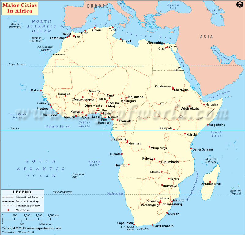
Cite this chapter
Mboup, G. (2019). African Cities in Time and Space: Past, Emerging Trends and Perspectives. In: Mboup, G., Oyelaran-Oyeyinka, B. (eds) Smart Economy in Smart African Cities. Advances in 21st Century Human Settlements. Springer, Singapore. https://doi.org/10.1007/978-981-13-3471-9_2
Download citation
DOI: https://doi.org/10.1007/978-981-13-3471-9_2
Published:
Publisher Name: Springer, Singapore
Print ISBN: 978-981-13-3470-2
Online ISBN: 978-981-13-3471-9
eBook Packages: Earth and Environmental ScienceEarth and Environmental Science (R0)