
Abstract
Monitoring and management of forest fire is imperative in India where 50% of forest cover is prone to the fire. The study aims for applying the geospatial technology towards forest fire characterization and evaluation of relationship with meteorological thematic layers. Spatial analysis of forest fires in the state of Arunachal Pradesh was carried out based upon the decadal (2008–2016) forest fire count datasets, which was assessed for spatial variability over the known Himalayan biodiversity hotspot in diverse geographical and socio-economic gradients. Result suggested that Kameng districts had maximum fire incidences (25.2%) whereas it has 15.2% of state forest, established the districts as ‘forest fire hotspot’ in the state. Maximum number of incidences (88%) occurred in areas of low elevation (< 1500 m). There was high correlation with socio-economy where 42.3% forest fire points falls in high poverty index areas and 73% of fire incidences in the areas having population density 6–50. All districts showed high fire incidences, therefore an urgent intervention is greatly required by the policy makers towards conservation and management of forest fire prevention and control by adopting focused intervention, strategic allocation of limited resources in potent areas in order to safeguard Himalayan region of highest biodiversity.
1 Introduction
Fire is one among major threats for the world’s forests which leads to tremendous loss to the bio-diversity and changes in several ecosystems [1, 2]. Forest fire destroys millions of hectares of the world’s forests every year, amounts to loss of human property and wildlife apart from release of tons of carbon to the atmosphere, raises costs on fire suppression and prevention heavily, and damage to other environmental, recreational and amenity values [3, 4]. Forest fires are largely found within the tropics as revealed from the study of satellite imagery which manifest maximum of fire events in this region [5].
Forest fire frequency, occurrence and its extent of spread worldwide can be characterized by weather and climatic condition [6], landscape fuel characteristics [7], ignition agents [8], and anthropogenic factors [9]. Forest fire frequency in India has greatly increased in last few decades due to drought, hot weather, and accumulated Chir Pine (Pinus roxburghii) needles which are inflammable due to its high-resin content and provide an abundant source of fuel for these wildfires. During year 2016, forest fire incidences have increased by 55% as per report by the Parliamentary Standing Committee on Science and Technology in India.
Various studies showed that in India human activity is generally the major cause of forest fires whereas its spread and extent largely depends upon the severity of weather condition [9]. People practice, clearing and burning forests as a part of shifting cultivation system [10], which is an old practice still prevailing in north-eastern Indian states [11]. Local communities having poor socio-economic conditions who live along the fringes of the forest continue to burn forests to support their livelihood by producing fodder and agriculture [10] and to facilitate the collection of non-timber forest products [12–14].
Arunachal Pradesh, with a forest cover of 80.3% of the geographic area known for Himalayan biodiversity [15]. Particularly, the north-eastern Region of Indian states of Assam, Arunachal Pradesh, Manipur, Mizoram, Tripura, Nagaland and Meghalaya where shifting cultivation is still in vogue extensively practiced by more than 100 tribal ethnic minorities due to their weak socio economic condition and poverty [16, 17]. As temperature increases during the summer, land is cleared by slash-and-burn shifting cultivation method.
Apart from topographical and metrological factors, forest fire incidences largely depends upon shifting cultivation practice (anthropogenic factor) and it is a major cause of forest degradation both qualitatively and quantitatively in Arunachal Pradesh. The availability of historical forest fire data is useful and can be utilized for management, planning and prevention of forest fires [18, 19]. Temporal and spatial trend of forest fire incidences and its topographic relationship with other parameters such as elevation, poverty and population density etc. provide insight into various issues which would help in solving problems for effective future planning and making strategies to minimize the forest losses.
Geospatial techniques such as remote sensing and GIS are powerful tools to evaluate the forest fire risks and fire trend analysis [20, 21]. Few studies have addressed the issues of forest fire trend and its relationship with the driving factors. Reddy et al. [22] studied forest fires extent and burnt area in the states of Andhra Pradesh, India using Advanced Wide Field Sensor (AWiFS) satellite remote sensing data. Compared analysis was carried out with respect to different forest types, protected areas (PAs) and elevation to demarcate and identify the fire-affected areas. The results exhibit that about 19% of forest area were burnt in the state during 2009. Reddy et al. [23] carried the study for whole India using Resourcesat-2 AWiFS data. They evaluated spatial and temporal patterns of fire occurrence, total burnt area and CO2 emissions covering natural vegetation types and PAs of India. The total burnt area for the year 2014 in the forest, scrub and grasslands were found as 48,765.45, 6540.97 and 1821.33 sq km, respectively whereas total CO2 emissions was estimated to be 98.11 Tg and it was suggested that PAs need strict fire management systems for climate change mitigation and biodiversity conservation. Rahman and Rashid [24] studied the tree damage due to ice storm in City of Norman, Oklahoma utilizing the data integrated airborne laser scanning (ALS) and geographic information systems (GIS). The analysis revealed approximately 9% of the urban trees is damaged due to storm. Saarinen et al. [25] carried out study in southern Finland demonstrated the capability of LiDAR for evaluating the probability of wind-induced forest damage (PDAM) and GIS was incorporated in the analysis, which revealed that open-access LiDAR data sets can be utilized to map PDAM without field data which provides significant information helps in forest planning.
Badrinath et al. [26] have studied forest fire incidence for the state of Kerala in India with Defense Meteorological Satellite (DMSP-OLS) having night-time active forest fire detection capabilities and compared DMSP-OLS-derived night-time fire products with synchronous Moderate Resolution Imaging Spectro-radiometer (MODIS)-derived daytime fire products and validated the study with AWiFS satellite imagery. Results showed a good correlation between AWiFS derived burnt areas, DMSP-OLS-derived fire counts and MODIS-derived fire products. Giriraj et al. [27] have studied 9 years night-time Advanced Along Track Scanning Radiometer (A) ATSR satellite data to identify high fire prone zones for India. The study revealed that during 1997–2005 the Central Highlands, Eastern Highlands, Central Plateau and Chhota Nagpur—of Deccan peninsula of India were the most affected and accounted for approximately 36% of the total fire incidences.
Ahmad and Goparaju [20] have studied fire incidence utilizing Forest Survey of India (FSI) forest fire data sets over the Jharkhand state of India between the years 2005 and 2016 and identified forest fire hotspot districts. One of the highest forest fire districts was analyzed based on grid with 2 km spacing. The study revealed that west Singhbhum district; Jharkhand had 30% of total forest fire containing 17% of the state forest cover. The study also highlights north-west of Pansuan dam of Porhat forest division of west Singhbhum district exhibit very high frequency forest fire grids. Vadrevu et al. [28] had evaluated the vegetation fire activity in India by using MODIS active fire datasets and evaluated various fire regime attributes in terms of fire frequency, seasonality, intensity and the type of vegetation affected in various diverse geographical regions.
The present study area was Arunachal Pradesh state which is also known for rich Himalayan biodiversity hotspot. The study has utilized the 9 years forest fire data (point data of location forest fire) and analyzed it on GIS platform towards visualization and evaluation of spatial and temporal dimension of fire pattern with objectives of studying temporal variation and to analyze forest fire events and its distribution across different vegetation types, topographical gradient and socioeconomic and demographic condition. It was further aimed to perform statistical analysis by Cramer V coefficient methodology using meteorological datasets to analyze its correlation with forest fire incidences and to generate fire hotspots for effective monitoring and strategic resource allocation.
2 Materials and methods
2.1 The study area
The study area is spread over entire Arunachal Pradesh state with geographical area 83,743 Km2 having 1.38 million populations out of which 68.8% is the tribal population. Its geographical expansion is from 26°37′23″N to 29°27′30″N latitude and 91°32′36″E to 97°24′42″E longitude (Fig. 1). The major rivers are Kameng, Subansiri, Siang, Dibang, Lohit and Noa-Dihing. The state has heavy topographic variation of altitude from 60 to 7000 m from the mean sea level (MSL). The climate of the state shows tremendous variation with the elevation. The low altitude (< 1500 m) shows humid subtropical climate whereas high altitude and very high altitude areas have a subtropical highland climate and alpine climate, respectively. The state receives annual rainfall of 2000–5000 mm, while 70–80% rainfall occurs during the month of May and October. Shifting cultivation is the major agriculture practice where land is cleared for growing crops by first clearing of trees and vegetation and then burning it thereafter. This area was chosen as it has alarming forest fire incidences and Himalayan ecology is very fragile. A research work in the said area will greatly help in maneuvering damages through forest fire and will significantly help in safeguarding the ecology.

Study area (a—India, b—Arunachal Pradesh)
2.2 Data preprocessing and analysis
Data used, attributes and rationale of using it (Table 1).
2.2.1 Forest fire analysis
Administrative boundary of state and districts were downloaded from DIVA GIS. To analyze the forest fire spatial and temporal trend during years 2008–2016 forest fire data was downloaded from FSI, which uses MODIS for active forest fire detection, which is a key instrument on Terra and Aqua satellites. Terra MODIS and Aqua MODIS having 36 spectral bands or groups of wavelengths view whole earth’s surface every one to 2 days.
The forest fire point file downloaded from FSI was in MS-EXCEL format with each location having its latitude and longitude. It was exported into vector point shape file (year wise) using ArcGIS software. The spatial pattern of forest fire was evaluated based upon the point density module of ‘Spatial Analyst’ tool of the software in terms of magnitude per unit area from existing fire point features that fall within a neighborhood around each cell. The ‘Calculate Density’ tool creates a spatial pattern of forest fire density map from fire point features and was classified from the least dense forest fire to most dense forest fire. Finally, by this process maps were generated showing forest fire hotspots area. Hotspot means areas with high forest fire magnitude per unit area.
2.2.2 Topographical data
Advanced Space-borne Thermal Emission and Reflection Radiometer (ASTER) DEM with 30 m spatial resolution was downloaded from the USGS with having 20 m accuracy at 95% confidence interval (CI) for vertical data and 30 m at 95% CI for horizontal data. Spatial Analyst tool was utilized to generate thematic layer such as elevation and slope, which was extracted corresponding to fire incidences.
2.2.3 Socio-economic and demographic data
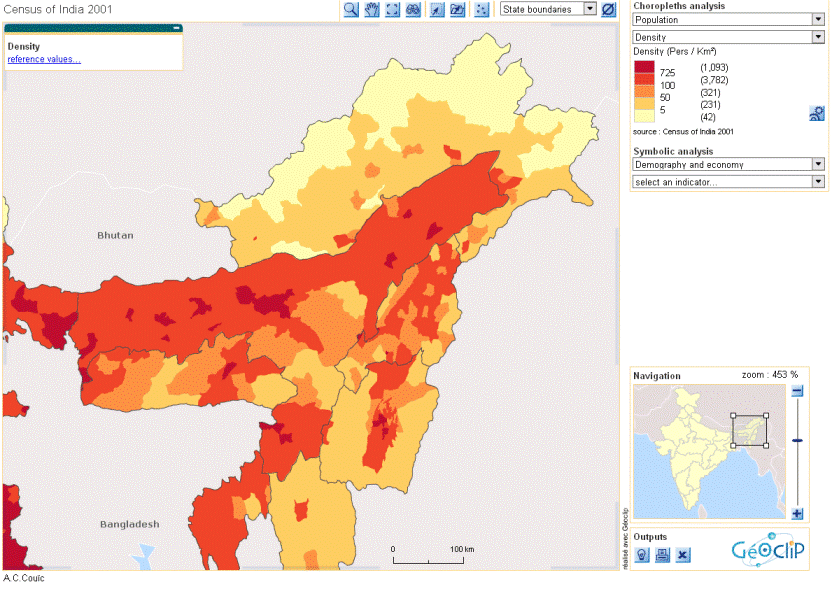
Methodology adopted by Nair et al. [29] was used for generating poverty map, which was brought in GIS domain (Fig. 2). The population density map was generated with the help of map.Footnote 1 Poverty index and population density index map data corresponding to fire incidences was utilized (Fig. 3).

Poverty map

Population density map
2.2.4 Vegetation data
The SPOT4 satellite based vegetation cover derived from ‘Vegetation instrument’ having 1 km resolution is VEGA 2000 dataset and was utilized in the study (Fig. 4). VEGA 2000 project uses legend defined by FAO Land Cover Classification System (LCCS). The regional partner plays key role in describing the land cover classes based on regional expertise knowledge to standardized classification approach. South central Asian regional datasets covering Indian region was utilized. The fire events in each vegetation was analyzed separately.

The SPOT satellite derived vegetation cover map of Arunachal Pradesh
2.2.5 Meteorological data
The National Centers for Environmental Prediction (NCEP) Climate Forecast System Reanalysis (CFSR) provides meteorological datasets such as maximum temperature, minimum temperature, precipitation, wind velocity, relative humidity and solar radiation on daily basis up to the year 2014. The 36 years meteorological data (Station Id: 283947) near to the forest fire hot spot from 1979 to 2014 on daily basis was downloaded and exported into ArcGIS shape file for further analysis. Above six weather parameters were averaged and evaluated month wise from November to June. The objective was to investigate the relationship of forest fire with these meteorological parameters.
2.3 Statistical analysis
The relationship of driving factors in terms of metrological data with forest fire was evaluated based upon CVC to find correlation between forest fire frequency (month wise) and metrologicalparameters. CVC value was calculated using Eq. (1), Liebetrau [30]
where φ is the coefficient of contingency, χ is derived from Pearson’s Chi-squared test, n is the grand total of observations and k represent number of columns and r represent number of rows in the month wise forest fire frequency. CVC was preferred over other statistical methods such as simple Pearson correlation coefficient due to the advantages of topology and therefore extracting the correlation coefficient between two sets of stochastic variables was significant and trouble-free.
3 Results
3.1 Forest fire frequency assessment
-
(a)
Year wise Annual frequency of forest fire during 2008–2016 was studied. Total occurrence of forest fire was 4429 out of which maximum 777 forest fire was found in the year 2009 and lowest (293) during year 2016 (Fig. 5).
Fig. 5 
Annual forest fire incidences during years 2008–2016
-
(b)
Month wise The forest fire frequency was analyzed monthly; it was found 73% of forest fire occurred in the month of March and April, during the beginning of summer season during the years 2008–2016 (Fig. 6).
Fig. 6 
Monthly forest fire frequency from 2008 to 2016
-
(c)
District wise forest fire frequency analysis The district wise analysis of forest fire data revealed that East and West Kameng, West Siang and Papum Pare districts had 25.2, 17.8 and 10.8% of fire incidences, respectively (Fig. 7).
Fig. 7 
District wise forest fire and forest cover percentage


Forest fire percentage and forest cover percentage based upon FSI 2015 report for each district was compared. Kameng districts surround 15.2% of forest cover of Arunachal Pradesh and it had 25.2% of fire incidences. West Siang district has 10.1% forest cover but had 17.8% incidences, while Dibang valley is least affected district from forest fire (2.6%) even though it is second highest district in terms of forest cover (13.9%).
3.2 Forest fire hotspot analysis
In the study, forest fire hotspot was extracted and spatial pattern of forest fire was integrated for the period of 2008–2016. Point Density sub-module of the Spatial Analyst tool of ArcGIS were used for generating density raster values based on utilizing all fire points. These raster values were stretched with colour representing fire frequency values. In this map, high values represented by colour red, medium value by yellow and low value by green (Fig. 8). Most of the southern Arunachal Pradesh was affected by the forest fire and it is maximum for Kameng districts. The increasing availability of detailed and accurate spatial datasets of forest fire enables us to identify forest fire hotspot and its extent and capability in management and prevention of forest fire [32].

Forest fire hotspot map using fire points over the period of 2008–2016
3.3 Forest fire incidences and vegetation cover
The number of forest fire incidences during years 2008–2016 analysis with vegetation types resulted tropical lowland forests, broadleaved, evergreen, < 1000 m vegetation class maximum (35%) incidences. Evergreen shrub-land and regrowth, abandoned shifting cultivation, extensive shifting cultivation class had 22% fire incidences whereas tropical and sub-tropical mountain forests, broadleaved, evergreen > 1000 m had 17.6%. The understanding of forest fire events with respect to various vegetation types is important in term of risk evaluation and in term of its consequences for the ecosystem [31–34].
3.4 Meteorological data analysis
The meteorological station data was used to analyze the relationship with forest fire. The nearest meteorological station (Point data-283947) recorded for all the six parameters from 1st January 1979 to 31st December 2014 on daily basis. The average monthly data from November to June was studied (Table 2). Further, monthly trend analysis of meteorological parameters was done based upon forest fire frequency using CVC methodology (Table 3).
The CVC values of relative humidity, precipitation, solar radiation and maximum temperature were found in the range of (0.32–0.40), demonstrating strong correlation with forest fire incidences. Wang et al. [35] described, CVC greater than 0.3 shows strong relationships with driving factors. Similar finding has been observed by Ahmad et al. [36].
3.5 Topography data analysis
The maximum percentage of fire incidences (88%) occurred in lower elevation (< 1500 m) whereas 50% of forest fire occurred where slopes were less than 20 degrees. Wind velocity and temperature are influenced by the elevation and it is an important physiographic factor which affects the fire susceptibility [37]. Forest fire usually spreads faster in uphill than downhill thus steeper the slope faster the fire movement [38].
3.6 Socio economy and demography data
Based upon the literature of Nair et al. [29] on poverty, it has categorized poverty index into five classes of very low (0–1), low (1–2), medium (2–3), high (3–4) and very high (4–5). The evaluation of forest fire counts reveals 42.3% (Fig. 9) forest fire points belong to high to very high poverty index area. The similar research finding was observed by Mercer and Prestemon [39] which showed a positive correlation between poverty and wildfire intensity. The population density map categorized into four classes (Fig. 10), which revealed 73% of forest fire occurs in the area where population density is 6–50 (Second category). Southern Arunachal Pradesh has more population (Fig. 3).

The forest fire frequency of different type of vegetation class. Vegetation types. a Coniferous mountain forests, evergreen > 1000 m. b Temperate mountain forests, broadleaved, evergreen > 1000 m. c Tropical and sub-tropical mountain forests, broadleaved, evergreen > 1000 m. d Tropical lowland forests, broadleaved, evergreen, < 1000 m. e Tropical mixed deciduous and dry deciduous forests. f Forest mosaics and degraded/fragmented forests. g Evergreen shrub land and regrowth/abandoned shifting cultivation/extensive shifting cultivation. h Deciduous shrub land/Mosaics of deciduous shrub cover and cropping. i Alpine grassland/grassland at high altitudes > 2500 m. j Mosaic of cropping, regrowth or other natural vegetation/intensive shifting cultivation. k Cropland, irrigated, inundated or flooded

The forest fire frequency and population density relationship
4 Conclusion
Spatial analysis of forest fires was carried out decadal (2008–2016) forest fire counts datasets. Fire counts were assessed for spatial variability over the known Himalayan biodiversity hotspot in diverse geographical, vegetation, topographical, demographic and socio-economic gradients dominated by tribal population whereas the point density based forest fire hotspot was generated to understand the overall spatial pattern. Monthly meteorological datasets showed a positive correlation with monthly forest fire counts as revealed by CVC statistical methods. And, with vegetation categories maximum number of forest fires occurred in tropical low land forests, broadleaved, evergreen, < 1000 m vegetation class (35%), while maximum number of fires (88%) was found in low elevation (< 1500 m). The study has reinforced the relationship between forest fire incidences and poverty as 42.3% incidences occurred in high to very high poverty index area. Further, a strong correlation was established with metrological parameters such as relative humidity, precipitation, solar radiation and maximum temperature with forest fire, while minimum temperature and wind velocity were found to be nearly unrelated.
It may be concluded that the spatial technology has tremendous potential in environment monitoring and assessment for forest fire incidences study and can be potentially used towards strategic resource allocation. The fire points (MODIS) and various vegetation types (SPOT-4) were used in this analysis which has spatial resolution of 1-km thus compromises the strength of the study. Had there been datasets with better resolution, results would be of much significance. Therefore, high resolution datasets will be required in future studies.
The state of Arunachal Pradesh is Himalayan biodiversity hotspot retain more than 60% tribal population most of them belong to low poverty indices. Majority of them practice shifting cultivation for their livelihood. The government bodies, NGO, local administration should initiate such program and involve them in various forest conservation activity through empowered village forest management committees (VFMCs) on the line of joint forest management (JFM), which in turn will enhance the livelihood opportunities and will reduce dependency on forest resources in greater extent.
Notes
Details are at http://www.demographie.net/atlas2001/Densite.gif.
References
Pew, K. L., & Larsen, C. P. S. (2001). GIS analysis of spatial and temporal patterns of human-caused wildfires in the temperate rain forest of Vancouver Island, Canada. Forest Ecology and Management, 140, 1–18.
Fearnside, P. M. (2005). Deforestation in Brazilian Amazonia: History, rates, and consequences. Conservation Biology, 19(3), 680–688.
Davidenko, E. P., & Eritsov, A. (2003). The fire season in 2002 in Russia. Report of the Aerial Forest Fire Service, Avialesookhrana. International Forest Fire News, 28, 15–17.
FAO. (2005). Global forest resources assessment. Chapter 4. Forest health and Vitality, p 60–65. http://www.fao.org/docrep/008/a0400e/a0400e00.htm. Accessed 30 Mar 2017.
Dwyer, E. J., Pereira, J. M. C., Gŕegoire, J. M., & Da Camera, C. C. (1999). Characterization of the spatio-temporal patterns of global fire activity using satellite imagery for the period April 1992–March 1993. Journal of Biogeography, 1, 57–69.
Flannigan, M. D., & Harrington, J. B. (1988). A study of the relation of meteorlogical variables to monthly provincial area burned by Wildfire in Canada (1953–1980). Journal of Applied Meteorology, 27, 441–452.
Finney, M. A. (2001). Design of regular landscape fuel treatment patterns for modifying fire growth and behavior. Forest Science, 47, 219–229.
Malamud, B. D., Millington, J. D. A., & Perry, G. L. W. (2005). Characterizing wildfire regimes in the United States. Proceedings of the National Academy of Sciences in the United States of America, 102, 4694–4699.
Saha, S., & Howe, H. F. (2001). The bamboo fire cycle hypothesis: A comment. The American Naturalist, 158, 659–663.
Gadgil, M., & Meher-Homji, V. M. (1985). Ecology and management of World’s Savannas. In V. M., Tothill & J. C. Mott (Eds.), Land use and productive potential of Indian savanna (pp. 107–113). Canberra: Australian Academy of Science.
Raman, T. R. S., Rawat, G. S., & Johnsingh, A. J. T. (1998). Recovery of tropical rainforest avifauna in relation to vegetation succession following shifting cultivation in Mizoram, North-East India. Journal of Applied Ecology, 35, 214–231.
Ganesan, R., & Setty, R. S. (2004). Regeneration of amla (Phyllanthus emblica and P. indofischeri), an important NTFP from southern India. Conservation and Society, 2, 365–375.
Rodgers, W. A. (1986). The role of fire in the management of wildlife habitats: A review. Indian Forester, 112, 845–857.
Saha, S. (2002). Anthropogenic fire regime in a deciduous forest of central India. Current Science, 82, 1144–1147.
FSI. (2015). http://fsi.nic.in/isfr-2015/isfr-2015-forest-cover.pdf. Accessed 15 Mar 2017.
Singh, J., Borah, I. P., Barua, A., & Baruah, K. N. (1996). Shifting cultivation in north east India—an overview. Jorhat: Newsletters, Rain Forest Research Institute ‘Deovan’.
Ramakrishnan, Ρ. S. (1993). Shifting agriculture and sustainable development: an interdisciplinary study from Northeastern India. New Delhi: Unescoand Oxford University Press.
Daiz-Delgado, R., Lloret, F., & Pons, X. (2004). Statistical analysis of fire frequency models for catalonia (NE Spain, 1975–1998) based on fire scar maps from Landsat MSS data. International Journal of Wildland Fire, 13, 89–99.
Chuvieco, E., Englefield, P., Trishchenko, A. P., & Luo, Y. (2008). Generation of long time series of burn area maps of the boreal forest from NOAA–AVHRR composite data. Remote Sensing of Environment, 112, 2381–2396.
Ahmad, F., & Goparaju, L. (2017). Geospatial assessment of forest fires in Jharkhand. Indian Journal of Science and Technology. https://doi.org/10.17485/ijst/2017/v10i21/113215.
Ahmad, F., & Goparaju, L. (2017). Assessment of threats to forest ecosystems using geospatial technology in Jharkhand State of India. Current World Environment, 12(2), 255–265. https://doi.org/10.12944/CWE.12.2.19.
Reddy, C. S., Harikrishna, P., Anitha, K., & Joseph, S. (2012). Mapping and inventory of forest fires in Andhra Pradesh, India: Current status and conservation needs. ISRN Forestry. https://doi.org/10.5402/2012/380412.
Reddy, C. S., Alekhya, V. V. L. P., Saranya, K. R. L., et al. (2017). Monitoring of fire incidences in vegetation types and protected areas of India: Implications on carbon emissions. Journal of Earth System Science, 126, 11. https://doi.org/10.1007/s12040-016-0791-x.
Rahman, M. T., & Rashed, T. (2015). Urban tree damage estimation using airborne laser scanner data and geographic information systems: An example from 2007 Oklahoma ice storm. Urban Forestry and Urban Greening, 14(3), 562–572.
Saarinen, N., Vastaranta, N., Honkavaara, E., Wulder, M. A., White, J. C., Litkey, P., et al. (2015). Mapping the risk of forest wind damage using airborne scanning LiDAR. International Archives of Photogrammetry, Remote Sensing and Spatial Information Sciences. https://doi.org/10.5194/isprsarchives-XL-3-W2-189-2015.
Badarinath, K. V. S., Sharma, A. R., & Kharol, S. K. (2011). Forest fire monitoring and burnt area mapping using satellite data: A study over the forest region of Kerala State, India. International Journal of Remote Sensing, 32(1), 85–102. https://doi.org/10.1080/01431160903439890.
Giriraj, A., Babar, S., Jentsch, A., Sudhakar, S., & Murthy, M. S. R. (2010). Tracking fires in India using advanced along track scanning radiometer (A) ATSR data. Remote Sensing, 2, 591–610.
Vadrevu, K. P., Csiszar, I., Ellicott, E., Giglio, L., Badarinath, K. V. S., Vermote, E., et al. (2013). Hotspot analysis of vegetation fires and intensity in the indian region. IEEE Journal of Selected Topics in Applied Earth Observations and Remote Sensing, 6(1), 224–238.
Nair, M., Ravindranath, N. H., Sharma, N., et al. (2013). Poverty index as a tool for adaptation intervention to climate change in northeast India. Climate and Development, 5(1), 14–32. https://doi.org/10.1080/17565529.2012.751337.
Liebetrau, A. M. (1983). Measures of association; quantitative applications in the social sciences series (Vol. 32, pp. 15–16). Newbury Park, CA: Sage Publications.
Stocks, B. J., Mason, J. A., Todd, J. B., Bosch, E. M., Wotton, B. M., Amiro, B. D., et al. (2002). Large forest fires in Canada, 1959–1997. Journal of Geophysical Research—Atmospheres, 108, 5.1–5.12.
Vázquez, A., & Moreno, J. M. (1998). Patterns of lightning and people-caused fires in peninsular Spain. International Journal of Wildland Fire, 8(2), 103–115.
Leblon, B., Kasischke, E., Alexander, M., Doyle, M., & Abbott, M. (2002). Fire danger monitoring using ERS-1 SAR images in the case of Northern Boreal Forests. Natural Hazards, 27, 231–255.
Leone, V., Koutsias, N., Martinez, J., Vega-Garcia, C., & Allgower, B. (2003). The human factor in fire danger assessment. In E. Chuvieco (Ed.), Wildland fire danger estimation and mapping. The role of remote sensing data (pp. 143–196). New Jersey: World Scientific.
Wang, W., Zhang, C., Allen, J. M., Li, W., Boyer, M. A., Segerson, K., et al. (2016). Analysis and prediction of land use changes related to invasive species and major driving forces in the state of Connecticut. Land, 5, 25. https://doi.org/10.3390/l&5030025.
Ahmad, F., Goparaju, L., Qayum, A., & Quli, S. M. S. (2017). Forest fire trend analysis and effect of environmental parameters: A study in Jharkhand State of India using Geospatial Technology. World Scientific News, 90, 31–50.
Rothermel, R. C. (1991). Predicting behavior and size of crown fires in the northern Rocky Mountains. Researcg Paper INT-438. Ogden, UT: U.S. Department of Agriculture, Forest Service, Intermountain Research Station, p 46.
Kushla, J. D., & Ripple, W. J. (1997). The role of terrain in a fire mosaic of a temperate coniferous forest. Forest Ecology and Management, 95, 97–107.
Mercer, D. E., & Prestemon, J. P. (2005). Comparing production function models for wildfire risk analysis in the wildland–urban interface. Forest Policy and Economics, 7, 782–795.
Acknowledgements
The authors are grateful to the USGS for free download of Landsat and DEM (ASTER) data which was used in the analysis. We are also greatful to the Forest survey of India (FSI), DIVA GIS, National Center for Environmental Prediction (NCEP) for providing free download of various dataset used in the analysis. And, also to the Department of Environment and Forests, Govt. of Arunachal Pradesh Itanagar for this opportunity of carrying out the research work.
Author information
Authors and Affiliations
Contributions
FA proposed the idea and analyzed the satellite and ancillary data in GIS domain, LG supervised the analysis, and added dimensions of metrological factors and drafted the manuscript. AQ made critical evaluation regarding GIS analysis and provided continuous feedbacks. All authors read and approved the final manuscript.
Corresponding author
Ethics declarations
Conflict of interest
The authors declare that they have no competing interests at all. The author(s) of this article has (have) verified that its article is original and that it does not violate any other publisher’s rights nor does it contain matters that may disgrace or invade privacy.
Electronic supplementary material
Below is the link to the electronic supplementary material.


Rights and permissions
About this article

Cite this article
Ahmad, F., Goparaju, L. & Qayum, A. Himalayan forest fire characterization in relation to topography, socio-economy and meteorology parameters in Arunachal Pradesh, India. Spat. Inf. Res. 26, 305–315 (2018). https://doi.org/10.1007/s41324-018-0175-1
Received:
Revised:
Accepted:
Published:
Issue Date:
DOI: https://doi.org/10.1007/s41324-018-0175-1