
Abstract
While commentary on the productivity of Irish pastures can be dated as far back as 55 BC, direct references to the different kinds of soil only begin in the eighth century AD. Early scientific information on Irish soils typically came from the endeavours of geologists or other professionals who studied rock and outcropping patterns. The Geological Survey of Ireland, a constituent of the Geological Survey of Great Britain and Ireland, developed small-scale county soil maps, largely for the southern counties in the mid-1800s. In relation to pedology, John Hodges, an Irish soil analyst described soil profiles in the 1850s in terms identical with those dated to the Dokuchaev School in 1880s Russia. Soil science in Ireland has typically been delivered with agricultural and environmental science at University level. Agricultural extension dates back to 1731 through the Dublin Society employment of itinerant instructors. The soil test, pioneered by P H Gallagher in the 1930s became the single most important tool for the advisory service. In their essays on the characteristics of Irish soil types he, together with Dr. Tom Walsh, laid the groundwork for future classification and mapping. In 1945, the Department of Agriculture established a research centre at Johnstown Castle, Co. Wexford. The soil division of An Foras Talúntais was headquartered there and the National Soil Survey of Ireland established. In 1980 the second edition, General Soil Map of Ireland, was published. This survey was discontinued in 1988. In 1998, the Spatial Analysis Unit was established in Teagasc a key output of which was the first nationally complete digital subsoil and indicative soil map in 2009. Not long after, the 3rd Edition National Soil Map of Ireland was launched in 2014, through the collaboration of the Spatial Analysis Unit and Teagasc Johnstown Castle.
Access provided by CONRICYT-eBooks. Download chapter PDF
Keywords
1.1 In the Past…
Favourable comments on the productivity of Irish pastures can be dated as far back as 55 BC (Murphy 2015) but direct comments or narratives on the different kinds of soil begin only in the eighth century AD. Using early Irish Law tracts, Kelly (1997) deduced that three classes of arable land and three classes of rough land were recognised. The main distinguishing criteria being vegetation (trees, shrubs..), access to water/wetness, and stoniness/shallowness. Stock-carrying capacity was rated in numbers of milch (24, 20, 16) or dry (16, 12, 8) cows per cumal. Some centuries later, Gerald of Wales (ca. 1183) noted soil diversity: ‘… soil soft and watery… rather sandy than rocky… fruitful and rich in its soils’. ‘In some places a blackish earth, in others clay and in many parts a mix of both together, as likewise there are sandy places where the ground is mixed earth and sand, sand and clay, gravel and clay or earth… The plains are well clothed with grass, and the haggards are bursting with straw’. Dealing with manorial centres in the 1250/1350 period, Murphy (2015) listed some of the details in manorial extents (a description and valuation of all the items on the manor). This included the principal types of land-use: arable, meadow, pasture and wood. Many English sources wrote effusively about Irish soil in the late sixteenth century including Stanihurst who described …so rich a kingdom, the Pastures are greene [in winter]…; Payne …soil for the most part fertil, and apte for wheat, rye, barley… and Dymmock who found that …the land lyeth very low and therefore very waterish and full of marishes… A comprehensive account of agriculture was written by Boate (1652) ranging over many aspects including soils, crops, animals manures, burning lime and procuring sea-sand and shells. Subsequently, William Petty in the 1660s who confined himself to what was visible over-ground assigned Irish land to two groups: ‘profitable’ and ‘unprofitable’ (Simington 1931–61). The former group included arable, pasture, meadow and timberland, while the latter consisted of shrubby wood, rocky land, red bog and mountain. For some counties, Petty’s commentary contained many references to agricultural practices such as liming, sanding and gravelling, aimed at increasing productivity (Simington 1931–61).
1.2 Geology and Geological Origins of Soil Research
Much of the early scientific information on Irish soils came from the endeavours of geologists or those other professionals who studied local rocks and their outcropping patterns. Boate (1652) may have pointed the way, having referenced the qualities of the Clare/Galway limestone-based mould, soils of various textures and ‘in some places a blackish earth’. In his treatises, Smith noted the contrasts between the soils and agriculture of the Devonian and Carboniferous sandstones in Co. Waterford (1746); the potential value of a soil map in Co Cork (1750) and soils in Co. Kerry (1756). Later that century, Young (1780) commented on the rockiness of Irish soilscapes: ‘…but the rocks here are clothed in verdure…the softest and most beautiful mould imaginable…’ In Co. Longford, Young noticed that even a two-inch thick layer of blue clay was sufficient to induce water retention. In a recent assessment of the roles of geology and soil in supporting cattle rearing, the contributions of Kirwan 1793, Meade 1806, Newenham 1809, Radcliffe 1814; and Shaw-Mason 1814–18, were noted (Collins 2016). Rock types and their associated soils were common themes in many of the (Royal) Dublin Society statistical surveys of the early 1800s, those of Fraser (1801, Wicklow), Sampson (1802, Londonderry), Tighe (1802, Kilkenny) and Townsend, (1810, Cork,) being particularly informative. The last-mentioned, Townsend, should be credited with introducing the pedologists’ term, ‘parent material ’, into the literature. Referring to the east/west valleys in Co. Cork, where sandstone debris from the mountains partially covers the limestone, he wrote: ‘The limestone is certainly not the parent of the soil which is found over it… the earth incumbent on the limestone owes its birth to another parent’ (Townsend 1810). While the primary objective was bog reclamation, the reports of the Bog Commissioners, 1814–18, (which included R Griffith, geologist) alerted many to a range of calcareous materials suitable for neutralising the growing problem of soil acidity.
The Geological Survey of Great Britain and Ireland, instituted in 1845, conducted geological surveys and research across the UK and Ireland. The Geological Survey of Ireland (GSI) was a constituent part and survey work in Ireland was conducted under its local director, Henry James (Herries Davies 1983, 1995). The early results, largely from southern counties, were presented in small-scale county maps. These were superseded by one-inch maps based upon the field survey work conducted between 1857 and 1890 (Kilroe 1907). Early geological mapping was motivated by the search for economic minerals with the examination of soils and subsoils being an integral part of the mission. Du Noyer was the chief collector of samples taken across Cork, Waterford and Kilkenny. The GSI Memoir Series accompanying map sheets for a greater part of the country contain references to the use and availability of a range of soil amendments, mostly calcareous sands, gravels and marls, as well as locations of limestone rock suitable for burning to lime. As the survey proceeded through the 1870s/80s the emphasis on pedological matters lessened and in parts of the sandstone areas of South Munster the drift (till) was so thin that commentary on the soil was not worthwhile. However, George Kinahan highlighted the case of soils in his many publications (Kinahan 1878, 1885/9, 1908a, 1908b) especially in his 1908 booklet: ‘Soils’.
1.3 Pedology, Agriculture, Education and Advisory
The recognition of the soil profile as the basic unit in soil survey has been dated to the 1880s in Russia (Dokuchaev 1883), but some decades previously, John Hodges, an Irish academic, soil analyst and author, described two soils in terms identical with those of the Dokuchaev School. In 1855/6, Hodges published compositional and descriptive data for the soils and subsoils of the Albert (Glasnevin) and Munster (Cork) Model Farms, together with advice on draining, trenching, crop selection and fertilisation reflecting the interwoven nature of the above-named disciplines in the 1850s. Hodges’ site, descriptive, compositional and commentary data were assessed and his work placed in context with the agricultural and educational developments of the period (Collins 2008). His interest and writings captured legacies and student progression that ascended from the Model Agricultural School system and transitioned to the Albert College and on to the Queen’s universities. Other eminent persons of the period include Robert Kane, Edmund Murphy and Wm Sullivan. Writing on pedological themes, Antisell (1845, 46) reviewed the works of Griffith, Hamilton, Oldham, Mallet, Wilkinson and Kane, and having discussed weathering (1845, Chap. 3), addressed the contribution of various Irish rock types to soil formation. The pioneering work and writings of James Murray on soil phosphorus during these decades deserves special mention (Cooper and Davis 2004).
Irish agriculture was also well-served during the 1800s by a wide range of agricultural societies, many publishing journals, pamphlets and gazettes. The nature and properties of soils featured regularly in most of them, the subsoil getting the most notice in those articles dealing with drainage, trenching and ridge-and-furrow construction. The most impressive tome was the 1280-page first issue of the Irish Farmer’s Journal in 1845; it included articles and notes on virtually every agricultural topic of the time including one entitled ‘On the application of geology to agriculture’ (p. 213). One of the most influential and prolific agricultural educators of the 1800s was Martin Doyle, co-editor with Edmund Murphy of Irish Farmers’ and Gardeners’ Magazine and Register of Rural Affairs in the 1830s. Between 1830 and 1834, no fewer than a dozen books and pamphlets, including a two-volume collected works, were published under the Martin Doyle pseudonym (Cadogan 1989). Cadogan concluded ‘…at a time when organic farming and self-sufficiency are enjoying a new vogue, his essays are as topical as when they first saw the light of day over 150 years ago…’
As a discipline, soil science in Ireland has typically been delivered with agricultural and environmental science at University level. Agricultural extension in Ireland dates back to the establishment of the Dublin Society (later Royal Dublin Society) in 1731 and its employment of ‘itinerant instructors’. State employment of instructors commenced with the establishment of the Department of Agriculture and Technical Instruction (DATI) in 1900. It is acknowledged that the soil testing, pioneered by P H Gallagher of UCD in the 1930s, became the single most important tool for the advisory service, leading to the transformation of Irish agriculture (Kirley 2008). Although the uptake of advisory services declined somewhat in the late 1980s, policy changes such as the Common Agricultural Policy (CAP) Reforms, the Rural Environment Protection Scheme (REPS) and the Green, Low-Carbon, Agri-Environment Scheme (GLAS) have seen an increased demand for advisory services. As well as Teagasc Agriculture and Food Development Authority, many private sector entities currently compete in the area of advisory service provision in Ireland.
1.4 Official Pedology, Pedogenic Investigations and Surveys
The establishment of DATI brought together diverse educational, scientific and administrative institutions including the Royal College of Science (a successor to the Museum of Irish Industry) and the County Committees of Agriculture (subsets of County Councils, established in 1898). One of its first commissioned publications, ‘Ireland, industrial and agricultural’ (Coyne 1902), included an eight-page article ‘The soils of Ireland’ by J R Kilroe; this was a forerunner for a much larger tome, ‘A description of the Soil-Geology of Ireland’ by Kilroe in 1907. The Geological Survey, under Grenvile Cole, joined in 1905 (Herries Davies 1995), turning its attention to soils and employing Timothy Hallissy as a soil physicist. The soils of the new Agricultural College farms at Athenry, Ballyhaise and Clonakilty and a Forestry School at Avondale, Co. Wicklow, were studied. Unacquainted with the new thinking from Russia or from USA, Hallissy and co-authors drew heavily on their geological experiences. Their map of the 800-acre Ballyhaise Farm, showing the spatial distribution of seven soil types (scale 1:5280) attracted widespread approval. Surveyed by Hallissy and Kilroe, their map was colour-printed in 1909 and was awarded a Grand Prix Diploma. A few years later the GSI undertook a soil survey of Clare Island, Co Mayo, the findings of which were published by the Royal Irish Academy (Hallissy 1914) and in a special Survey Memoir (Cole et al. 1914). Hallissy may have been echoing the thoughts of many when he asserted that ‘the soils occur in such a variety that a complete description of them is impossible, and were it possible, the labour necessary for full investigation of their properties would not be justified by the results’.
The study of both edaphology and pedology and, indeed, education/advisory to farmers, progressed significantly following the appointment of P H Gallagher at UCD, in 1928 (See Collins 2008, pp 462–7 and bibliography). While soil fertility and mineral nutritional considerations were addressed during the 1930s, it was Gallagher’s research into the characteristics of Irish soil types that gained most prominence. Co-authored with T Walsh, their essay laid the groundwork on which future mapping and classification was to progress. In a 1944 paper (‘The Soil’), Gallagher criticised those who would be satisfied with classifications such as ‘Arable No.1’, ‘Arable No. 2’, etc. and he outlined his scheme of using colour indicator dyes to aid soil advisory work (Gallagher 1944). On joining the State Department of Agriculture (Soils division), Walsh’s position on the staff of the Faculty of Agriculture, UCD, was taken by W D (Bill) Brickley. Most of those who followed a career in soil science from the 1950s onwards studied under Gallagher, Walsh and/or Brickley. Gallagher’s paper was not published but readers of the proceedings would have noted Bishop’s statistic and would have made a mental calculation spanning many centuries: ‘…the loss of tricalcium phosphate to this country mainly through the export of cattle during the past few years has been somewhere between 20,000 and 30,000 tons per year’ (Bishop 1944). Much of the pedogenic research emanating from the Faculty of Agriculture, UCD, has been carried out on projects associated with the National Soil Survey (Fig. 1.1).

Soil map of Ballyhaise Agricultural College, Co. Cavan. This map won a prize at a French conference in 1916, and a copy remains framed on the wall at Ballyhaise, which continues to be an agricultural education and training centre today
In 1945, the Department of Agriculture established a research centre at Johnstown Castle, Co. Wexford (Fig. 1.2). Prior to this, some soil testing had been initiated at Ballyhaise Agricultural College from 1943. By 1958, Johnstown Castle had already established its name in soil fertility and grassland research, carried out in conjunction with research trials to improve grassland productivity. Fertiliser compounds were developed based on the research of that time (Miley 2008b). The post-war European Recovery Plan or Marshall Plan was established in 1947 to rebuild Europe after World War II with money from the United States of America. Ireland was neutral during the war but was eligible for funding due to its role as a food exporter to the UK (Miley 2008a). Joesph Carrigan, head of the Economic Co-operation Administration in Dublin, first proposed the development of a research institute in 1949. In late 1958 an institute for agricultural research, An Foras Talúntais (AFT), was established. In 1988, Teagasc Agriculture and Food Development Authority succeeded both AFT and An Chomhairle Oiliúna Talmhaíochta, the Agricultural Training Council (ACOT) which was the division responsible for education and advisory services. For over 50 years, AFT, ACOT and Teagasc have occupied a central role in research, advisory and training related to soil research in Ireland.

Johnstown Castle near Wexford town, where the Department of Agriculture established a research centre in 1945. The later An Foras Talúntais, the Agricultural Institute, and its descendant Teagasc were headquartered on this campus. Photo: Brian Murphy
In the post-war period, soils in Ireland were significantly deficient in fertility. According to G A Holmes, a New Zealand government’s agricultural attaché in London, it was a miracle that grass was found to grow, given the economic and political instability coupled with the limited use of fertiliser inputs (Miley 2008b). In 1950, research by Walsh et al. (1950) found that over 90% of soil samples were either ‘very’ or ‘moderately’ deficient in phosphorus (P) , over 50% were deficient in potassium (K) and fewer than 50% were satisfactory for lime. Setting up its Soil Division headquarters at Johnstown Castle, AFT established the National Soil Survey of Ireland, under the guidance of Pierce Ryan. Amongst its other programmes, most urgent was the correction of soil acidity, mainly with ground limestone, and the avoidance of mineral nutrient deficiencies.
On joining the European Economic Community (EEC) in 1973, the role of agriculture as a major growth area for the Irish economy was widely recognised. Adequate knowledge of the land resource was considered essential for agricultural development and was a major driver of the soil survey (Gardiner and Radford 1980). In 1980, the second edition, General Soil Map of Ireland (Scale 1:575,000) and an accompanying bulletin by Gardiner and Radford (1980) were published (Fig. 1.3). The explanatory bulletin, No 36, included a description of the major soil types and assessed their land-use potential. Covering approximately 44% of the country, the soils of ten full counties were mapped and published: Wexford, Carlow, Lime rick, Clare, Westmeath, Meath, Laois, Kildare, Leitrim and Offaly. Partial county surveys are published for west Mayo, west Donegal, Tipperary North Riding and West Cork. The National Soil Survey was discontinued in 1988, even though ‘Soils of Co. Waterford’ was published as Soil Survey Bulletin No 44, in 2011 (Diamond and Sills 2011). In the 1990s, environmental concerns, such as potential loss of nutrients from land, risking eutrophication of freshwaters, changed the emphasis of soil studies, moving away from agricultural production toward ecosystem science.

The second edition national soil map of Ireland published by an Foras Talúnais in 1980, to accompany Gardiner and Radford’s Soil Associations of Ireland and their Land Use Potential
-
Dr. Thomas Walsh (1914–1988) MAgrSc, DSc, PhD, LLD, ScD, MRIA (Fig. 1.4).
Fig. 1.4 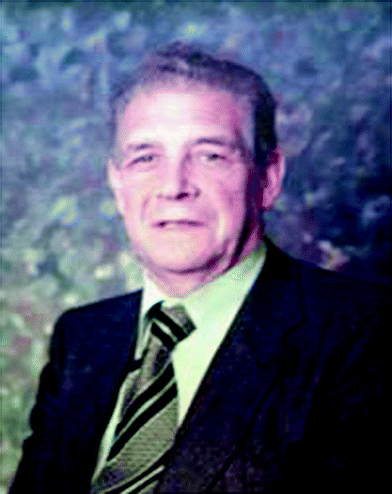
Dr. Tom Walsh, Director of An Foras Talúntais for its first 22 years (1958–1980) during which time he firmly established AFT as a leading centre in soil science research

Born in Piercestown, Co. Wexford, Dr. Walsh graduated from University College Dublin (UCD) in 1937 with an honours degree in Agricultural Science. The following year he completed his master’s degree in the same subject, his Ph.D. in 1941, and he was awarded a DSc for his published work in 1947. During his time at UCD (1938–1945), Dr. Walsh lectured in soil science, after which he worked as Soil Advisory Officer in the Department of Agriculture (1945–1954) and it was he who led the campaign on tacking the issue of soil fertility (O’Dwyer 2008). Dr. Walsh is considered the single most influential figure in the development of the internationally renowned agricultural and soil research infrastructure in Ireland which shaped the agriculture and food industry of today (O’Dwyer 2008).
During his lifetime, Dr. Walsh was very active in a large number of scientific organisations. He was elected a member of the Royal Irish Academy (MRIA) in 1956 where he served on the Council, as Senior Vice-President, as Science Secretary and as Secretary. He was a member of the Science Committee of the Royal Dublin Society and in 1969 was awarded the Society’s Boyle Medal, for outstanding contribution to science in Ireland. He served on the Commission for Higher Education and was Chairman of the National Council for Educational Awards (NCEA) during the 1970s. He was appointed Director of An Comhairle Oiliúna Talmhaiochta (ACOT, the national farm advisory body) in 1980. He retired from public life in 1983.
In 1998, the Spatial Analysis Unit (SAU) was established in Teagasc to conduct work on the Irish Forest Soils project (FIPS-IFS). At the outset of the FIPS-IFS project, less than half of the country’s soils had been surveyed and published at detailed reconnaissance (1:126,720) scale. The FIPS-IFS project resulted in a methodology to create an indicative soil classification and map for those areas not previously surveyed by the National Soil Survey, using satellite and aerial remote sensing and Geographical Information Systems (GIS). Inherent in this was the production of a soil parent material map. The SAU extended these efforts through the Environmental Protection Agency (EPA)/Teagasc Soil and Subsoil Mapping project leading to the first nationally complete digital subsoil and indicative soil maps created by a unified methodology (Fealy et al. 2009).
Notwithstanding the range of soil research and mapping undertaken since the 1950s, a comprehensive inventory by Daly and Fealy (2007) found that soil data coverage of Ireland was incomplete in both detail and extent. Shortly afterwards, the Irish Soil Information Systems (SIS) project was established in 2008, jointly funded by the EPA and Teagasc. A third edition National Soil Map of Ireland (Creamer et al. 2014) was developed using a combination of traditional soil survey methods and new GIS predictive mapping methods (see Chaps. 3 and 4). The 3rd Edition map also incorporated the legacy data generated in the earlier soil surveys and developed a harmonised legend for the soils of Ireland. This map and its soil database were launched in September 2014, coinciding with the centenary year of Dr. Walsh’s birth.
The Joint Working Group on Applied Agricultural Meteorology (AGMET) has published soil relevant works including Climate, Weather and Irish Agriculture (Keane and Collins (1986), Agro-Meteorological Modelling—Principles, Data and Applications (Holden 2001, Chap. 4: Terestrial Data) and the Agroclimatic Atlas of Ireland (Collins and Cummins 1996). In ‘Quickening the Earth—Soil Minding and Mending in Ireland’ Collins (2008) provides an account of agriculturalists’ interaction with, and management of, land and soil over many centuries. The Soil Science Society of Ireland, formed in 1977, promotes the knowledge and use of, Irish soils. The members are professionally active in research, teaching, administration, consultancy, advisory services, state agencies, civil service and industry (SSSI 2016). The Irish Quaternary Association, Irish Peatland Conservation Council, and member organisations of the Irish Geoscience Network all continue to work to improve understanding of soils and the integration of soil knowledge into other disciplines.
References
Antisell T (1845) A manual of agricultural chemistry, with its application to the soils of Ireland. Hodges and Smith, Dublin
Bishop DW (1944) Mineral resources. In: The natural resources of Ireland: a series of discourses… RDS, Dublin, pp 55–61
Boate G (1652) Ireland’s natural history, being a true description… Hartlib, London
Cadogan T (1989) Rev. William Hickey/‘Martin Doyle’ (1778–1875): agricultural educator and essayist. Bandon Hist J 5:36–42
Cole GAJ, Kilroe JR, Hallissy T, Newell Arber EA (1914) The geology of Clare Island, Co. Mayo. Memoirs of the geological survey of Ireland, DATI, Dublin
Collins JF (2008) Quickening the earth: soil minding and mending in Ireland. UCD School of Biology and Environmental Science, Dublin
Collins JF (2016) Geology soils and cattle production chapter 1. In: O’Connell M, Kelly F, McAdam JA (eds) Cattle in ancient and modern Ireland Cambridge Scholars publishing, Newcastle upon Tyne, UK
Collins JF, Cummins T, (1996) (eds) Agroclimatic Atlas of Ireland. AGMET, Dublin
Cooper M, Davis J (2004) The Irish fertiliser industry: a history. Irish Academic Press, Dublin
Creamer R, Simo I, Fealy R, Hallett S, Hannam J, Holden A, Jones B, Massey P, Mayr T, McDonald E, Reidy B, Sills P, Truckell I, Zawadzka J, Schulte R (2014) National soil map of Ireland. Teagasc Agriculture and Food Development Authority, Cranfield University, Environmental Protection Agency, Washington, D.C.
Daly K, Fealy R (2007) Digital soil information system for Ireland (2005-S-DS-22), Final Report. Environmental RTDI programme 2000–2006, Environmental Protection Agency, Johnstown Castle, Wexford
Diamond J, Sills P (2011) Soils of Co. Waterford, Soil Survey Bulletin No. 44. National Soil Survey of Ireland, Teagasc, Co, Carlow
Dokuchaev VV (1883) Russian chernozem (trans: Kaner N). Jerusalem, Israel Programme for Scientific Translations
Fealy RM, Green S, Loftus M, Meehan R, Radford T, Cronin C, Bulfin M (2009) Teagasc EPA soil and subsoils mapping project-final report. vol I. Teagasc. Dublin
Fraser R (1801) General view of the agriculture and mineralogy, present state and circumstances of the County Wicklow: with observations on the means of their improvement, drawn up for the consideration of the Dublin society. Fraisberry & Campbell, Dublin
Gallagher PH (1944) In: ‘The soil’, a lecture by Dr P.H. Gallagher at the Sir Robert Kane Centenary symposium held by the Royal Dublin Society, 14 Apr 1944. Typescript Courtesy of Soil Science Group, UCD
Gardiner MJ, Radford T (1980) Soil associations of Ireland and their land use potential. Explanatory bulletin to the soil map of Ireland 1980. Soil survey bulletin No. 36. An Foras Talúntais. Dublin
Hallissy T (1914) Clare Island survey: geology. Proceedings of the Royal Irish Academy, 31 (1911–15), section 1, part 7
Herries Davies GL (1983) Sheets of many colours: the mapping of Ireland’s rocks, 1750–1890. Royal Dublin Society, Dublin
Herries Davies GL (1995). North from the Hook, 150 years of the geological survey of Ireland. Geological Survey of Ireland
Holden NM (2001) (ed) Agri-meteorological modelling:-principles, data and applications. AGMET, Dublin
Keane T, Collins JF (1986) (eds). Climate, weather and Irish agriculture, joint working group on applied agricultural meteorology (AGMET), c/o Met Éireann, Dublin
Kelly F (1997) Early Irish farming. Dublin Institute for Advanced Studies, Dublin
Kilroe JR (1902) The soils of Ireland. In: Coyne WP (ed) Ireland industrial and agricultural. Brown & Nolan Ltd., Dublin, pp 28–35
Kilroe JR (1907) A description of the soil-geology of Ireland based upon geological survey social inquiry society of Ireland, vol XVIX, part V, 1956/1957, pp 104–136
Kinahan GH (1878) Manual of the geology of Ireland. Keagan Paul, London
Kinahan GH (1885/9) Economic geology of Ireland. Royal Geological Society of Ireland, Dublin
Kinahan GH (1908a) Superficial and agricultural geology—Ireland. No. 1 Lime. Sealy, Bryers and Walker, Dublin
Kinahan GH (1908b) Superficial and agricultural geology—Ireland. No. 2 Soils. Sealy, Bryers and Walker, Dublin
Kirley T (2008) A century of advisory services for farmers. In: Miley M (ed) An Foras Taluntais—50 years of agriculture and food research, Teagasc Dublin
Miley M (2008a) Establishment and evolution of an Foras Talúntais. In: Miley M (ed) An Foras Taluntais—50 years of agriculture and food research, Teagasc Dublin
Miley M (2008b) Soils, grass and environmental research at Johnstown Castle. In: Miley M (ed) An Foras Taluntais—50 years of agriculture and food research, Teagasc Dublin
Murphy M (2015) Manor centres, settlement and agricultural systems in Ireland, 1250–1350. In: Murphy M, Stout M (eds) (2015) Agriculture and settlement in Ireland. Four Courts Press, Dublin, pp 69–100
O’Dwyer T (2008) Destined for high office—a profile of the ‘Doc’. In: Miley M (ed) An Foras Taluntais—50 years of agriculture and food research, Teagasc Dublin
Sampson GV (1802) Statistical survey of the county of Londonderry: with observations on the means of improvement. Graisberry and Campbell, Dublin
Soil Science Society of Ireland (SSSI) (2016) Soil Science Society of Ireland (website) http://www.ucd.ie/sssi/Home.html. Accessed 05/07/2016
Simington RC (1931–61) The civil survey A.D, 1654–1656. Irish Manuscripts Commission, Dublin
Smith C (1746) The antient and present state of the county and city of Waterford, Reilly, Dublin
Smith C (1750) The antient and present state of the county and city of Cork. Reilly, Dublin
Smith C (1756) The antient and present state of the county of Kerry. Ewing et al, Dublin
Tighe W (1802) Statistical observations relative to the county of Kilkenny: made in the years 1800 & 1801. Graisberry and Campbell, Dublin
Townsend H (1810) Statistical survey of the county of Cork. Graisberry and Campbell, Dublin
Walsh T, Mannion L, Ryan PF (1950) Some aspects of the fertility status of Irish soils. Trans Int Cong Soil Sci, vol 3
Young A (1780) A tour in Ireland, with general observations on the present state of that Kingdom in 1776–78, 2 vols. Messrs. Whitstone et alia, Dublin
Author information
Authors and Affiliations
Corresponding author
Editor information
Editors and Affiliations
Rights and permissions
Copyright information
© 2018 Springer International Publishing AG, part of Springer Nature
About this chapter

Cite this chapter
O’Sullivan, L., Collins, J.F., Cummins, T., Fealy, R., Creamer, R. (2018). A History of Soil Research with Emphasis on Pedology. In: Creamer, R., O’Sullivan, L. (eds) The Soils of Ireland. World Soils Book Series. Springer, Cham. https://doi.org/10.1007/978-3-319-71189-8_1
Download citation
DOI: https://doi.org/10.1007/978-3-319-71189-8_1
Published:
Publisher Name: Springer, Cham
Print ISBN: 978-3-319-71188-1
Online ISBN: 978-3-319-71189-8
eBook Packages: Earth and Environmental ScienceEarth and Environmental Science (R0)